Location
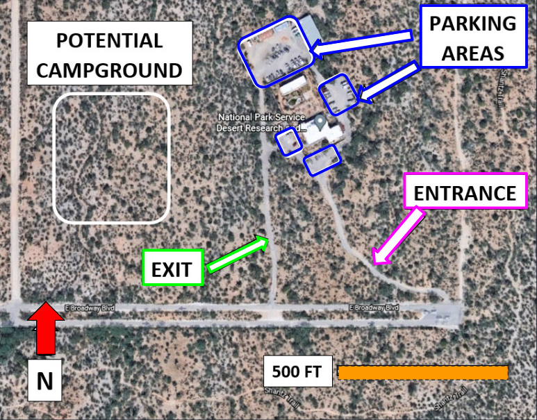
Figure 1-3 (found in the "Background" link under the "Project Information" tab) shows the site layout and some of the existing conditions. The Research Center has one entrance roadway and one exit roadway that are both narrow and have dips created by natural washes. The entrance roadway goes around the East side of the site and continues looping around the buildings. The exit roadway is reached as the loop continues around the West side of the site and ends at Broadway Blvd. There are 3 septic tanks located on the site: one at the Southeast corner of the Education Center building, one to the North of the project site, and one in the area of the North parking lot.
The site appears to have been chip sealed before NPS acquired the land from the previous owners. Little pavement remains and the parking lot is mostly gravel and dirt. There are several buildings on the site including an education center at the South side of the site, an apartment building at the North end of the site, and a fire station at the Northeast side of the site. The Research Center can see about more than 50 people at a time. Large groups mostly come in buses or vans. The entire parcel owned by the NPS is 40 acres and there are plans for a new campground on the West side of the site.
The existing parking lot faces issues such as a lack of signage, little to no asphalt, poor street lighting and narrow pathways. A campground is being developed on the southwest side of the property. A parking pullout is needed on the right hand shoulder of the exit road. The current site meets the ADA requirements for parking as it has 2 handicap-designated parking spaces; however, a new ramp will also be added on the East side of the Education Center building.

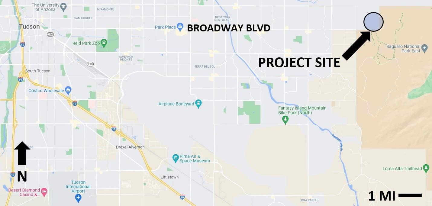
Figure 1-2: Project Vicinity (Google Maps)
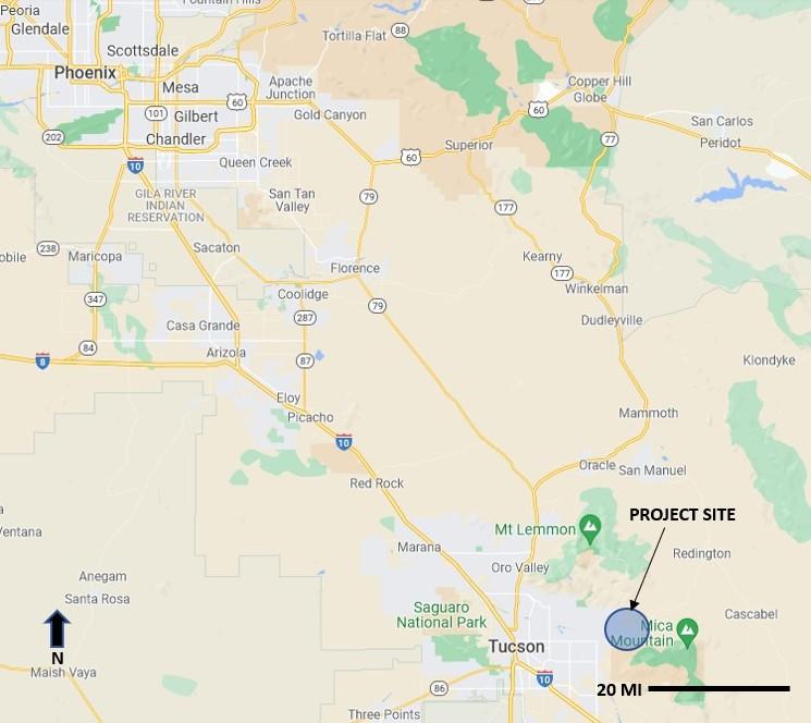
The general location of the project site is approximately 15 miles East of Tucson, Arizona, as shown in Figure 1-1. The locations of Phoenix and other cities relative to the project site are also included in the figure.

Figure 1-1: Project Location (Google Maps)

This is site map of our project. This is located at the end of East Broadway Blvd in Tucson, Arizona. The green is the exit road, the red is the north arrow, the pink is the entrance road, the orange is the scale, the white is the potential campground, and the blue is the parking areas.

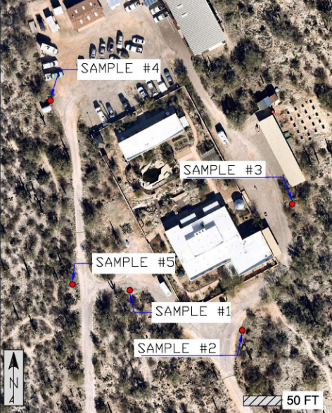
This is our soil sampling map. We took one sample from each lot and the parking pull out; the north lot, the south lot, the east lot, and the west lot.