Survey Analysis
Survey Analysis
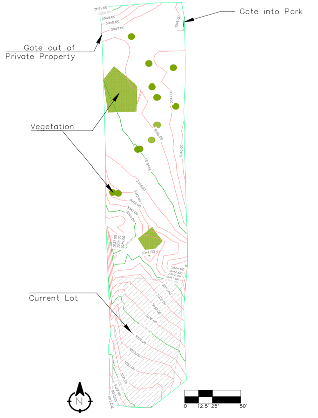
From the conducted survey, the topography map created in Civil 3D. Looking at the figure below there are a few points of interest that are denoted. On the northern end of the site there are two different gates, one on the east and one on the west. These gates are entrances and exits from the site into private or national park land. On all sides but the southern end, the site is surrounded by fences leading into this private property. The green hatch marks in the figure are showing areas of vegetation that will need to be removed when the site will be developed. The total area of vegetation on site that will need to be removed is approximately 1,592.12 square feet. The removal of this material will be analyzed as an additional cost in the total site development. The current lot area takes up about 6,704.7 feet or about a quarter of the total surveyed area.
The topography found in this area was seen to have moderate drainage grade leading from the northeast of the site to the southwest of the site. Looking halfway through the figure there is a channel located on the west side that most of the water from the north end of the site leads into. There is also a set of large boulders between the current site and the northern end that channel the water into the middle of the site.

