Project Information


Location


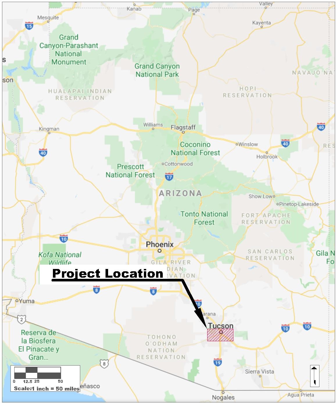
Map of Arizona

The map of Arizona above displays that the project location, the red stripped box, is in Tucson which is in the southern area of the state.
The scale on the lower left corner of the Arizona map is 1 inch equal to 50 miles. The north arrow is located on the lower right corner.

Card image cap

Figure 1: Map of Arizona

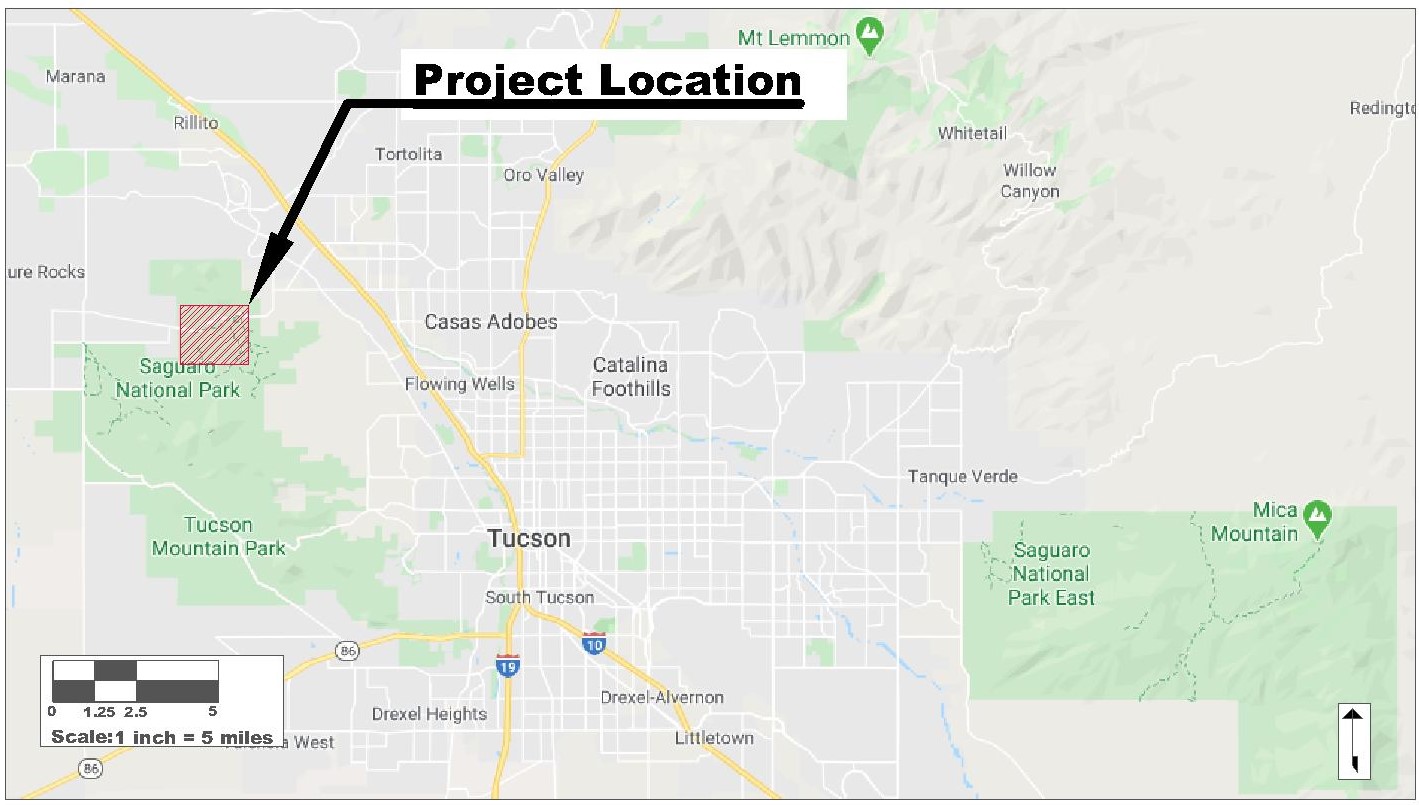
Map of Tucson

The map to the left displays the greater Tucson area with a red stripped box displaying where the project location is at. The parking lot is being designed to compensate horse trailers and prevent "wildcat" parking on the sensitive desert landscape. Consideration during the design process will be taken due to the travel time being approximately five hours. The project is located in the Saguaro National Park near the North Tucson Mountain Park District. The site is located in the northwest region on the greater Tucson area, just to the west of the I-17.


The scale, located on the lower left corner of the image, on the Tucson area map is 1 inch equal to 5 miles. The north arrow is located on the lower right corner of the image.


Card image cap

Figure 2: Map of Tucson


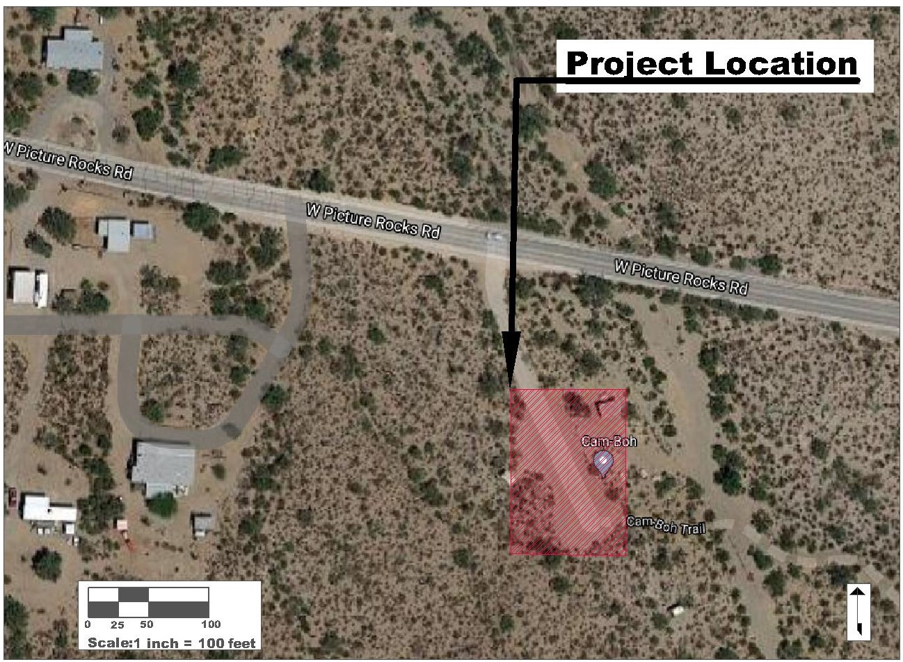
Site Map

The parking lot will be design for the red stripped box seen in the map to the left. There are residential houses to the west of the park which these stakeholders should be taken into consideration for the project design. The parking lot will be located off of Picture Rocks Road in Saguaro National Park. The Cam-boh picnic area at the north end of the project location site, as well as, the restroom facilities will need to be considered for the design of the parking lot. To the east of the project location is a natural drainage wash which will be used as the primary stromwater drainage point for the design. The site will need to be evaluated for any protected vegetation including Saguaro cactus and Ironwood tree for purposes of increasing the parking lot footprint.

The scale, located on the lower left corner of the image, on the Site map is 1 inch equal to 100 feet. The north arrow is located on the lower right corner of the image.


Card image cap

Figure 3: Map of Site Location


The project site area is located in the southern part of Arizona, in Saguaro National Park located in the Tucson Mountain District seen in Figure 1. The current and intended site, the Cam-boh Picnic Area (32°19'9.98"N, 111° 9'57.97"W), is located on the west side of Saguaro National Park just south of Picture Rock Road, 12.5 miles north-west of Tucson, Arizona seen in Figure 2. The available land encompasses approximately 4.5 square acres. The site is between a small development of residential homes and a natural wash that is approximately 160 feet to the west of the park’s entrance displayed in Figure 3. The site’s associated trail is the Cam-boh Trail – which runs parallel to Picture Rock Road from Cam-boh Picnic Area and is a major connection between the east and west parts of the Tucson Mountain District providing several loop opportunities for mountain bikers, hikers, and equestrian riders [1].

Reference:
[1] Red Hills Visitor Center. “Trails in the Tucson Mountain District,” U.S. Department of Interior, National Park Service, Saguaro National Park. Tucson, Arizona: US Department of the Interior, 2020, pp. 1-2. Available: https://www.nps.gov/sagu/planyourvisit/upload/Trails%20in%20the%20Tucson%20Mountain%20District.pdf [Accessed: February 4, 2020]..


Card image cap

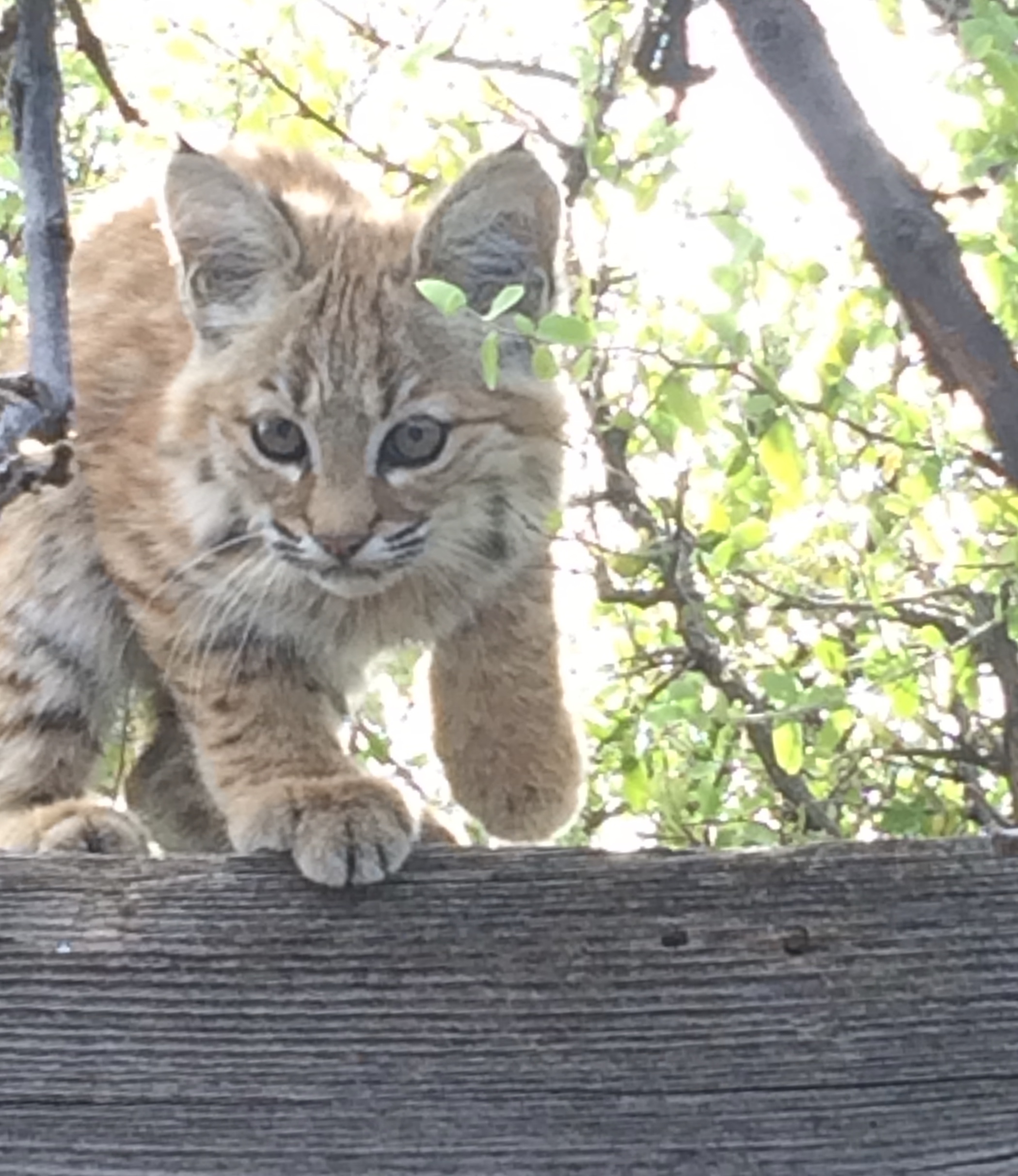
Bobcat

The Bobcat is amoung the larger predatory mammals in the Sonoran Desert. Other large predators include cyotes, mountain lions, and wolves. Cyotes and Bobcat are the most commonly seen.

Photo By: Desmin Fontaine

Photo Date: November 5, 2017


Card image cap

Mule Deer

Mule deer are among the most numerous and wide spread deer in Arizona. The Rocky Mountain Mule Deer are the larger of the two main big-game deer in the state over the white-tail deer.

Photo By: Desmin Fontaine

Photo Date: November 9, 2016

Card image cap

Rattlesnake

Rattlesnakes are one of the most dangeous desert creature. Rattlesnakes are most commonly identified by their rattles that warn nearby travelers. The Green Mojave rattlesnake, seen in the picture above, is more dangerous due to their neurotoxic venom.

Photo By: Desmin Fontaine

Photo Date: April 19, 2020


Saguaro Natl Park Copyright © 2020 · Saguaro Systems Engineering · All Rights Reserved ·
·Last Update-November 17, 2020 ·