Details of Final Design
Project Plans
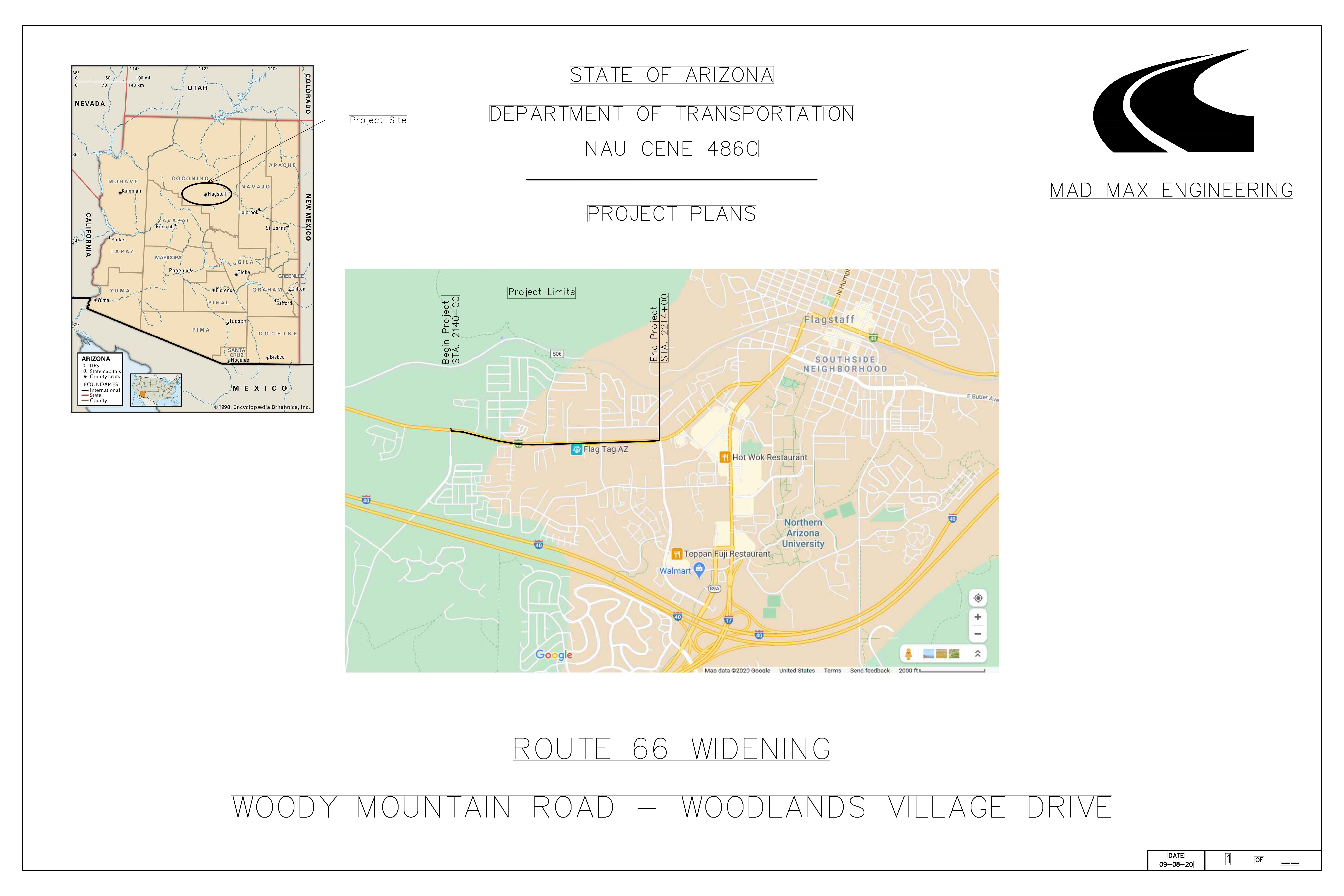
This page is a break down of the different details in the plan set that was created.
Typical Cross Section
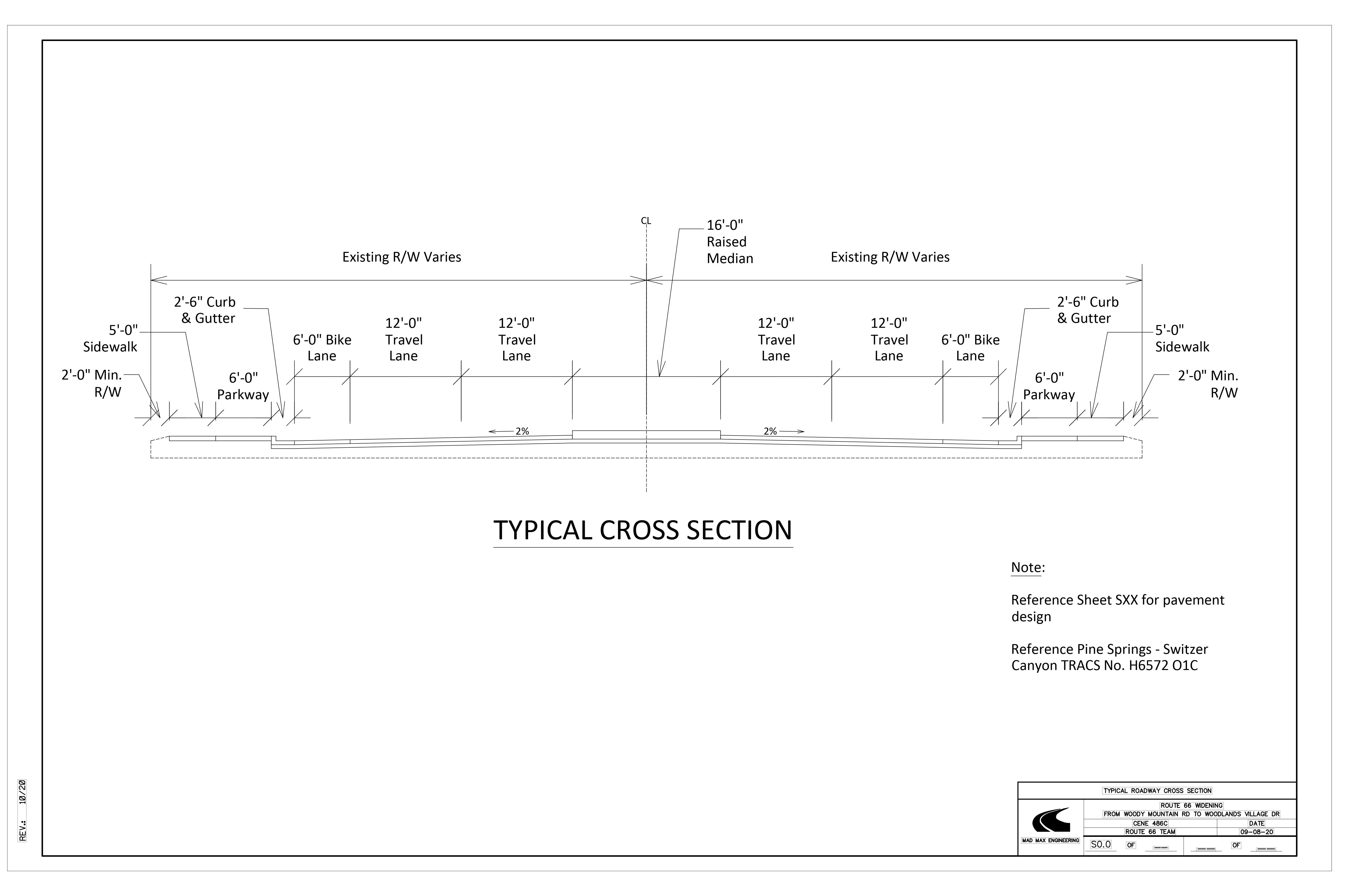
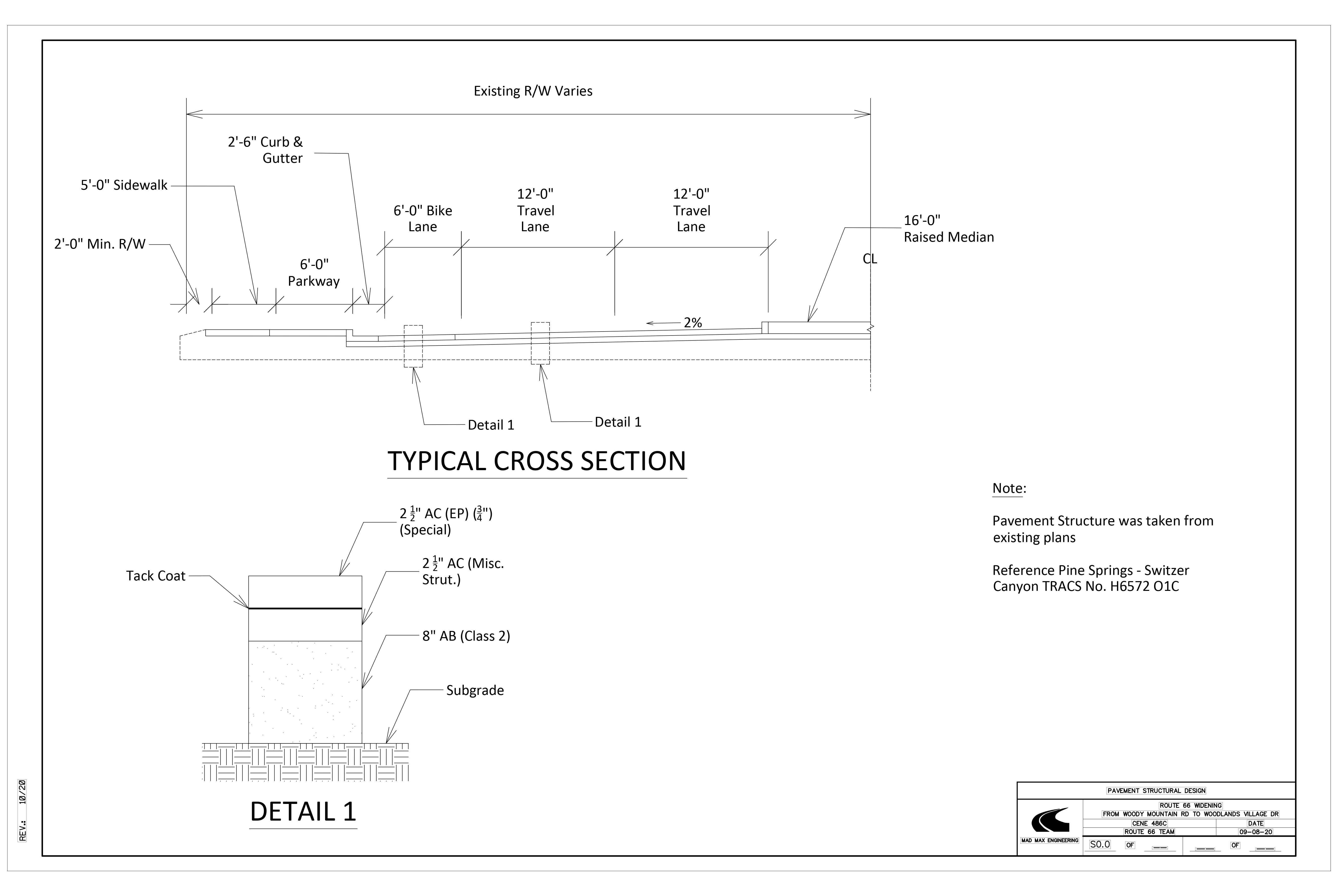
The following are sheets from the plan set that cover the typical cross section of the roadway with the pavement design that will be used. These sheets also provide the dimensions of the components of the roadway. The cross section was suggested by the client (ADOT) and will be utilized for this project. The typical layout of the roadway will consist of a 16-foot-wide raised concrete median, two 12-foot travel lanes with a 2% slope, a 6-foot bike lane, 2 1/2 foot curb and gutter, 6-foot park way, 5-foot sidewalk and a 2-foot minimum right of way on either side of the roadway. With the raised median, there will only be left turns at the intersections of Woody mountain road, Railroads springs Blvd., South Thompson St., and woodlands village Blvd. If users need to turn on other side streets that were accessible by left turns previously, will now need to make U-turns at the major intersections. There will also be traffic signals at the 4 intersections that were mentioned. The turning bays and acceleration bays that accompany the new design, will be 12 feet wide and are 380 feet long using the design vehicle WB-50. For left turn lanes in the median area, the median will taper to 4 feet wide.
Combines Striping
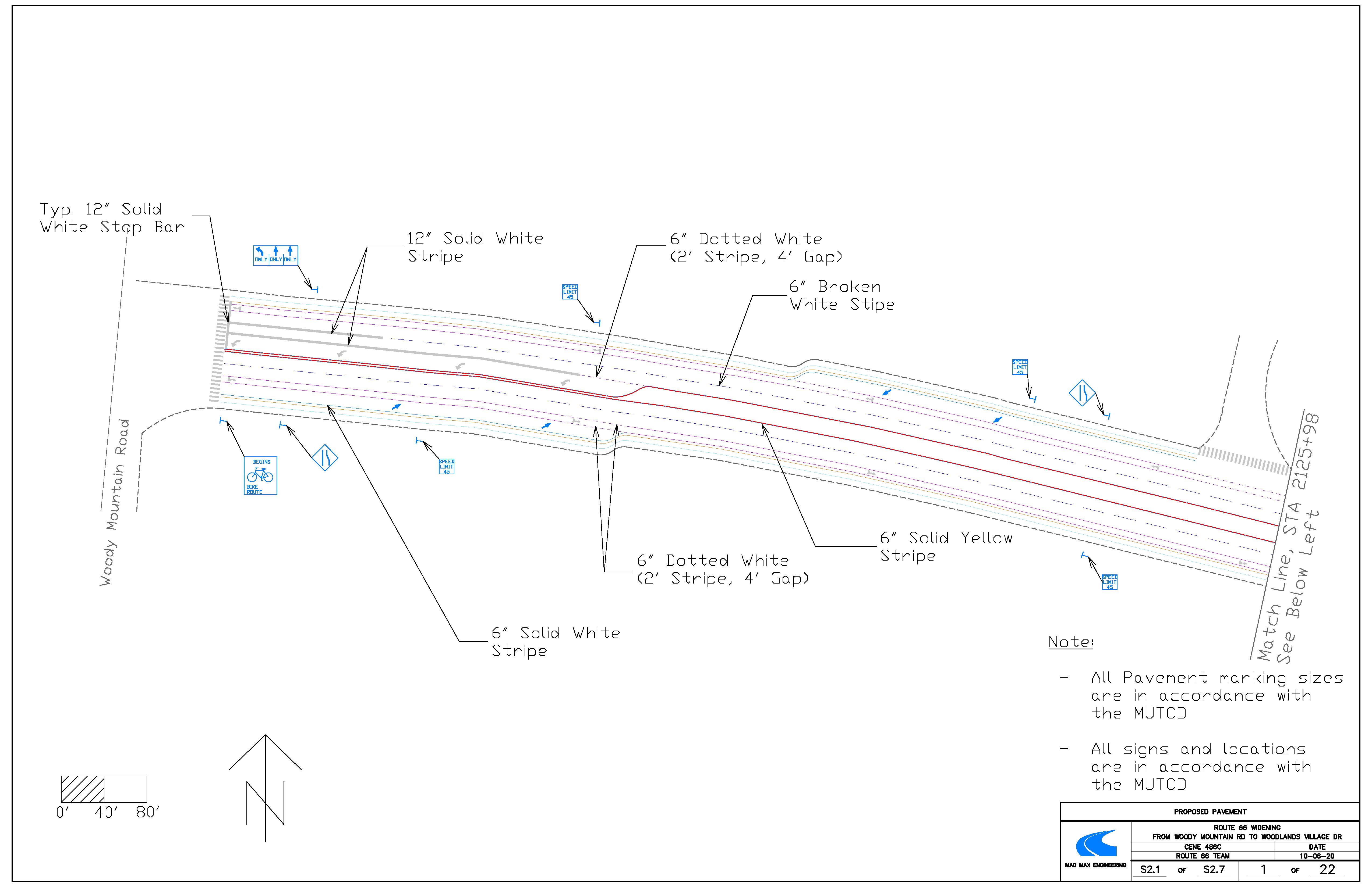
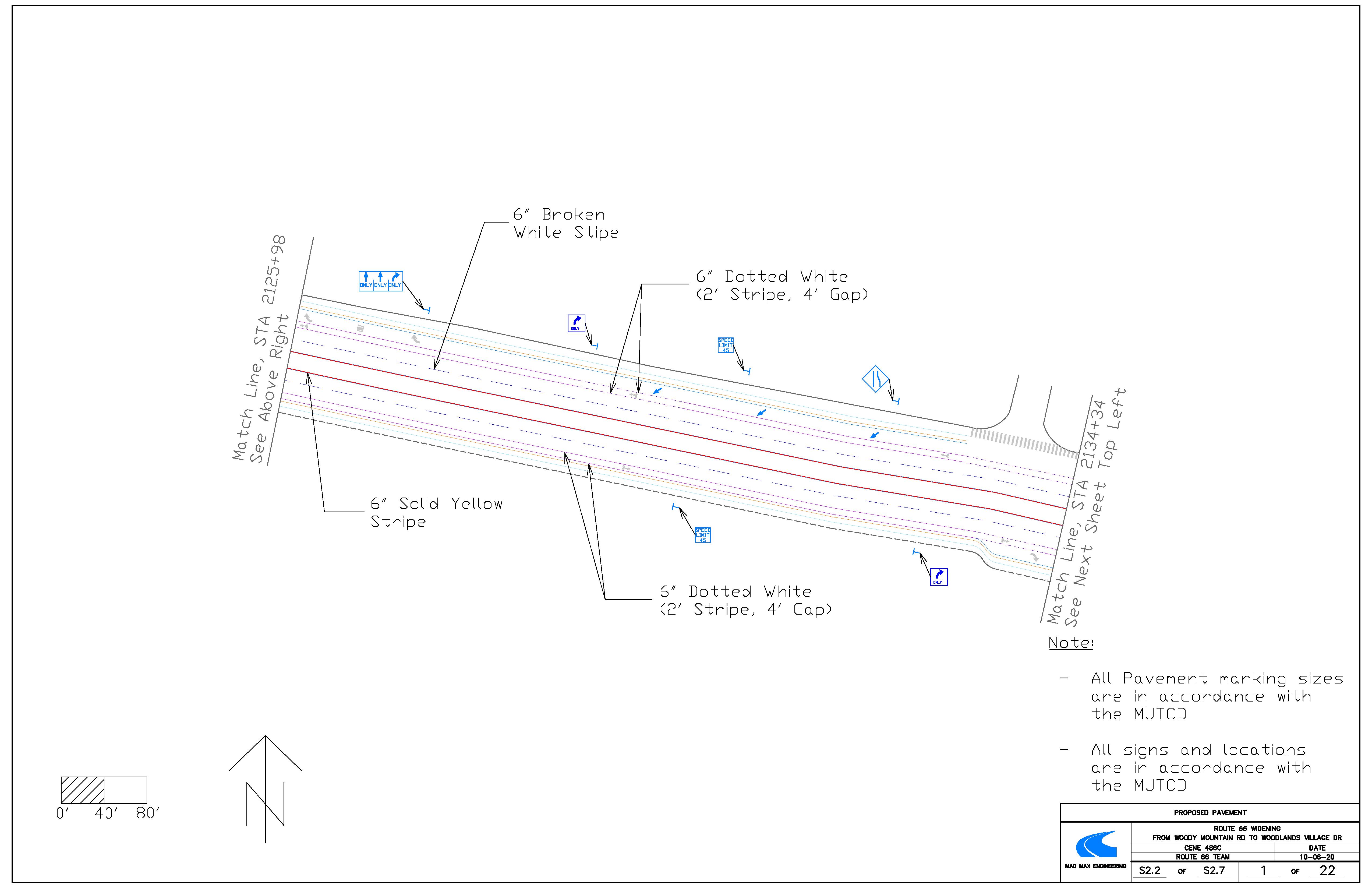
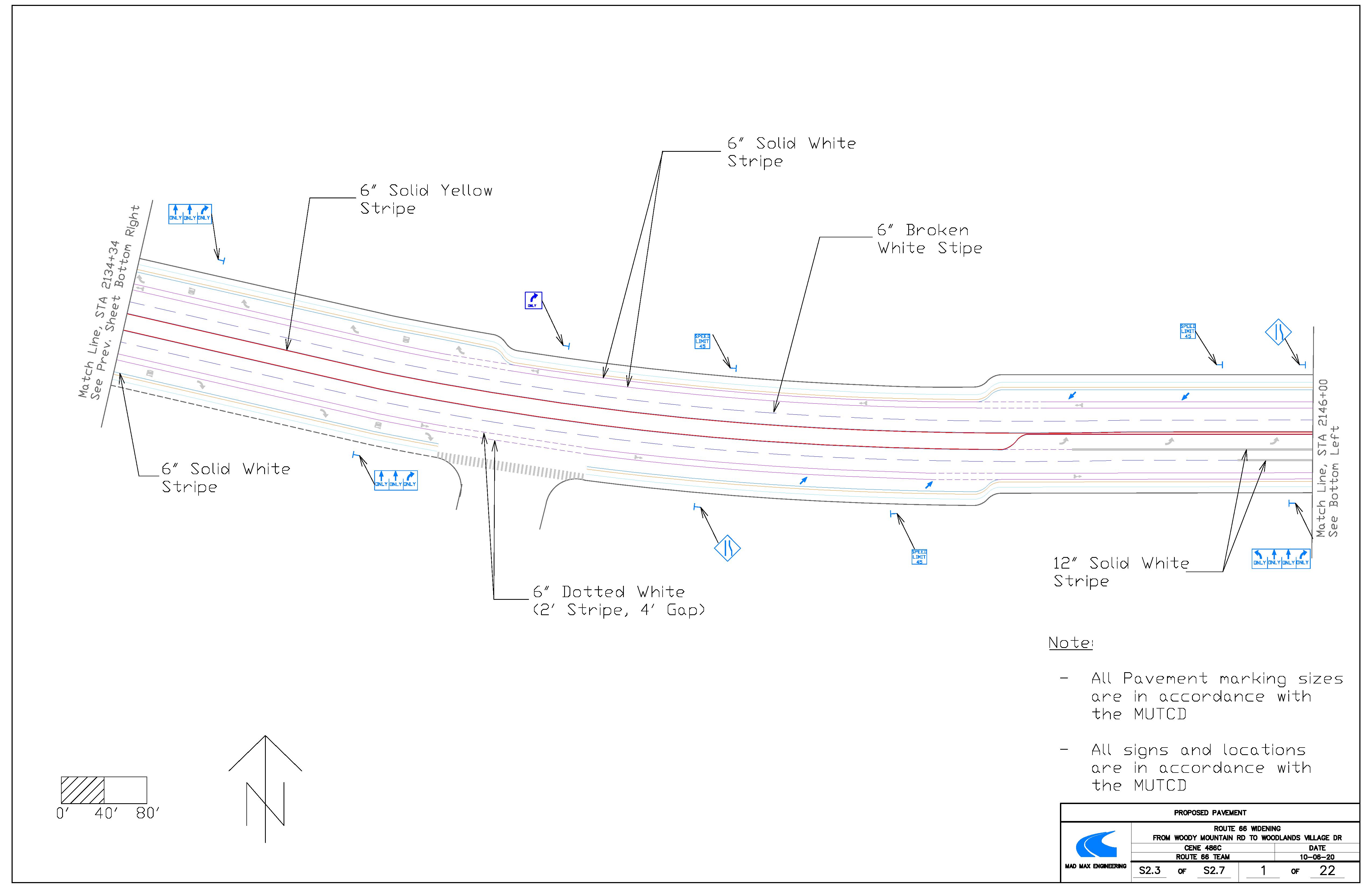
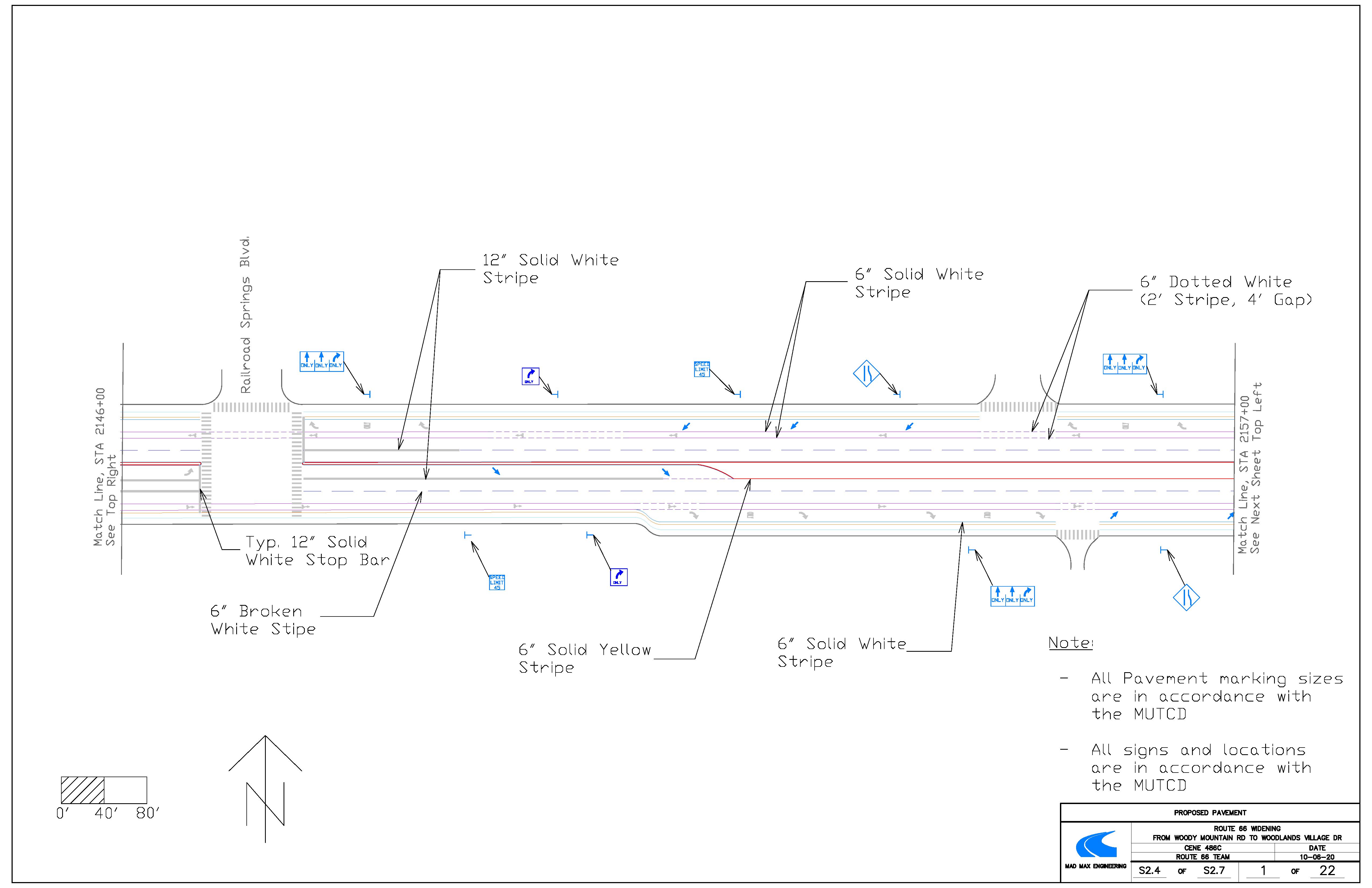
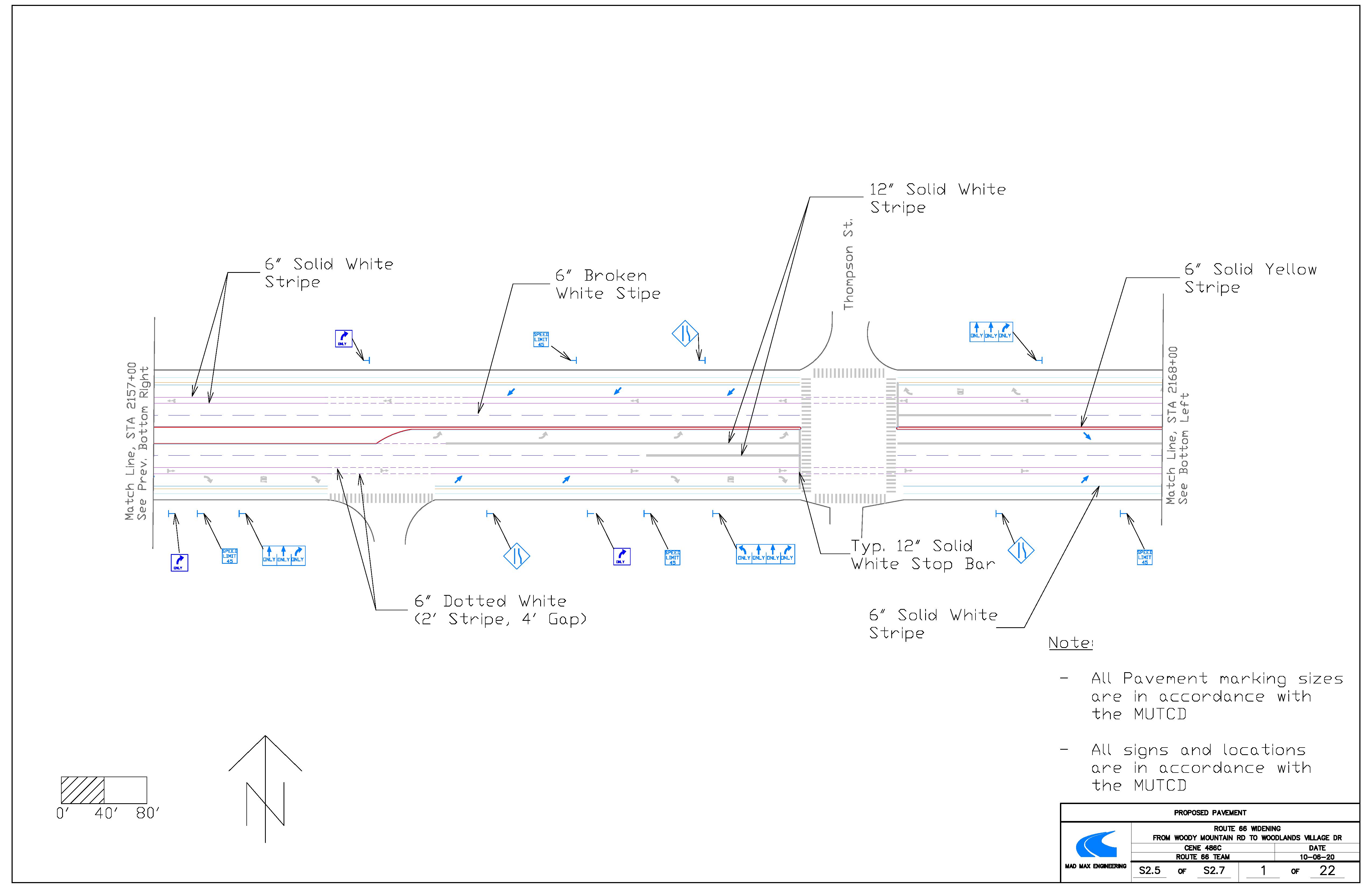
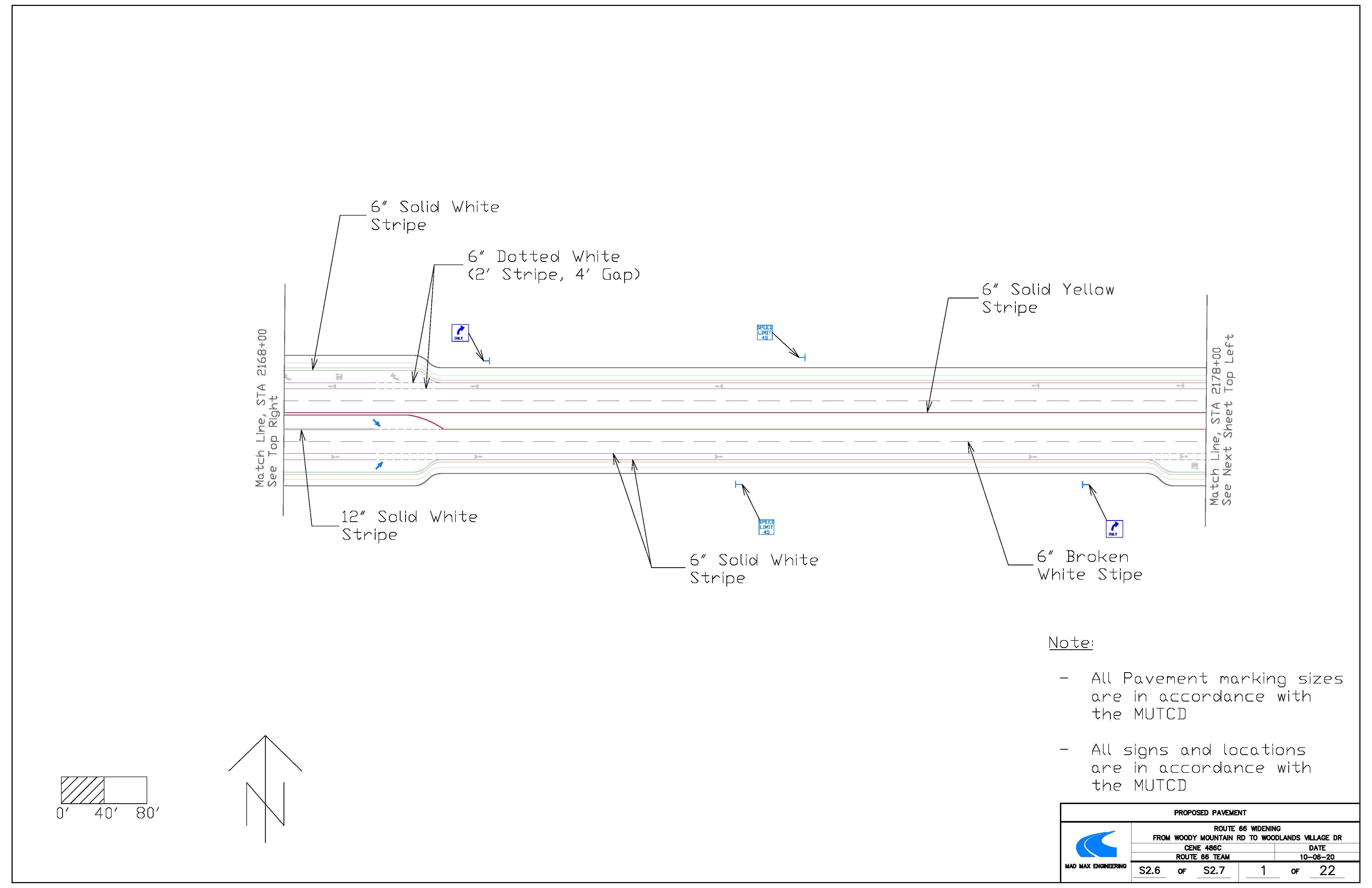
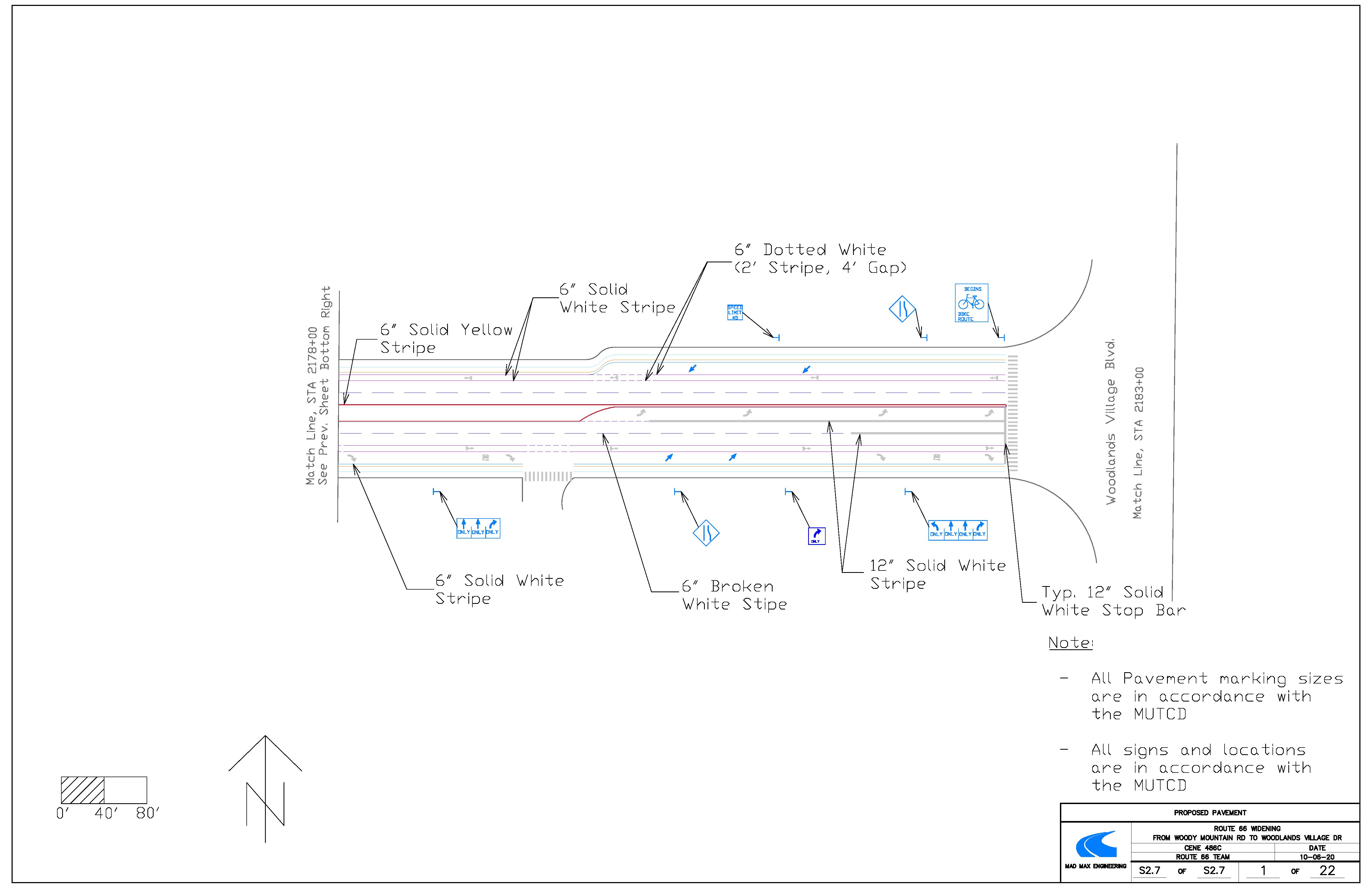
The following are a display of the striping , pavement markings, and sign locations and type along Route 66. The base for this file was taken from the proposed widening. From there, the stripes, markings and signs could be placed. All signs, striping and markings are in accordance with the MUTCD and ADOT standard drawings. For dimensions of the arrows and bike lane markings, refer to MUTCD and ADOT standard drawings. The roadway will consist of white and yellow pavement markings. The 6-inch wide solid yellow striping will only travel along the median. The 6-inch wide solid white stripe will be used to separate traffic at intersection approaches, turning bays, merging lanes and bikes lanes. The 6-inch wide broken white stripe will separate the travel lanes. The 6-inch wide broken white stripes that are 2-foot-long with 4-foot spacing will be used for turning bays and merging lanes when users can enter them. The bike lanes will have the same stripes as they travel through an intersection. And the 12-inch solid white stripe will be used for stop bars and cross walks at each intersection.
Plan and Profile View
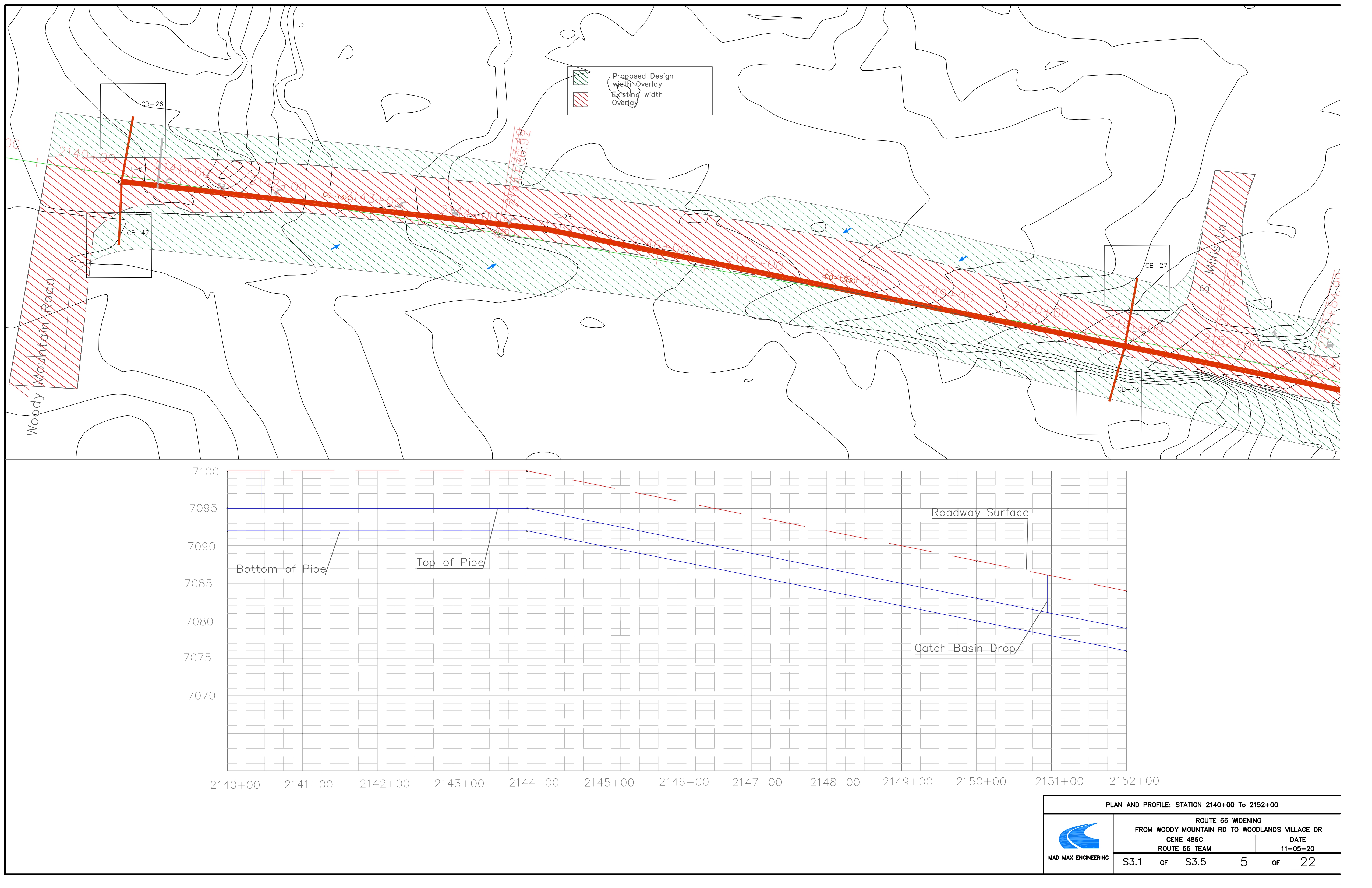
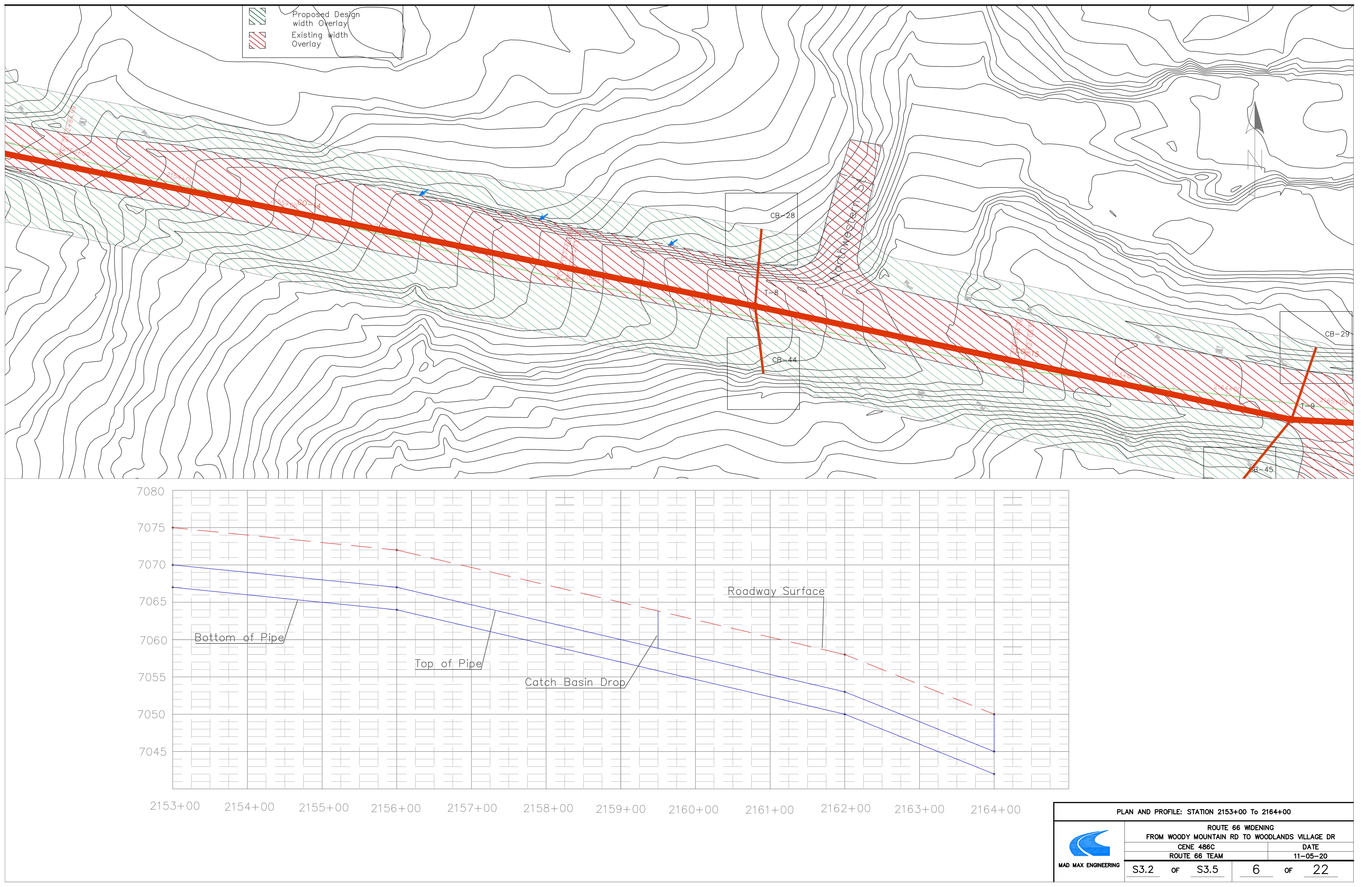
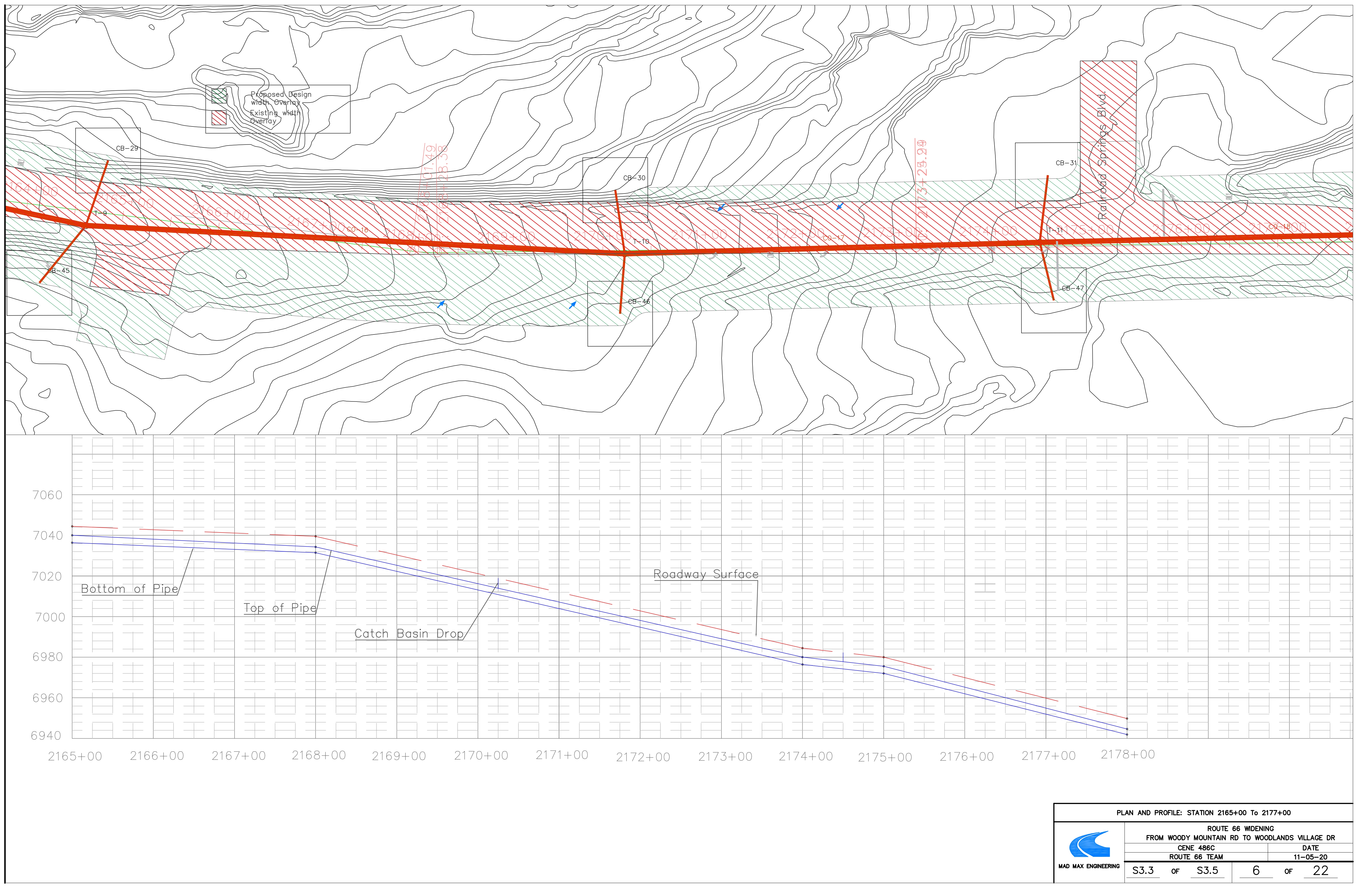
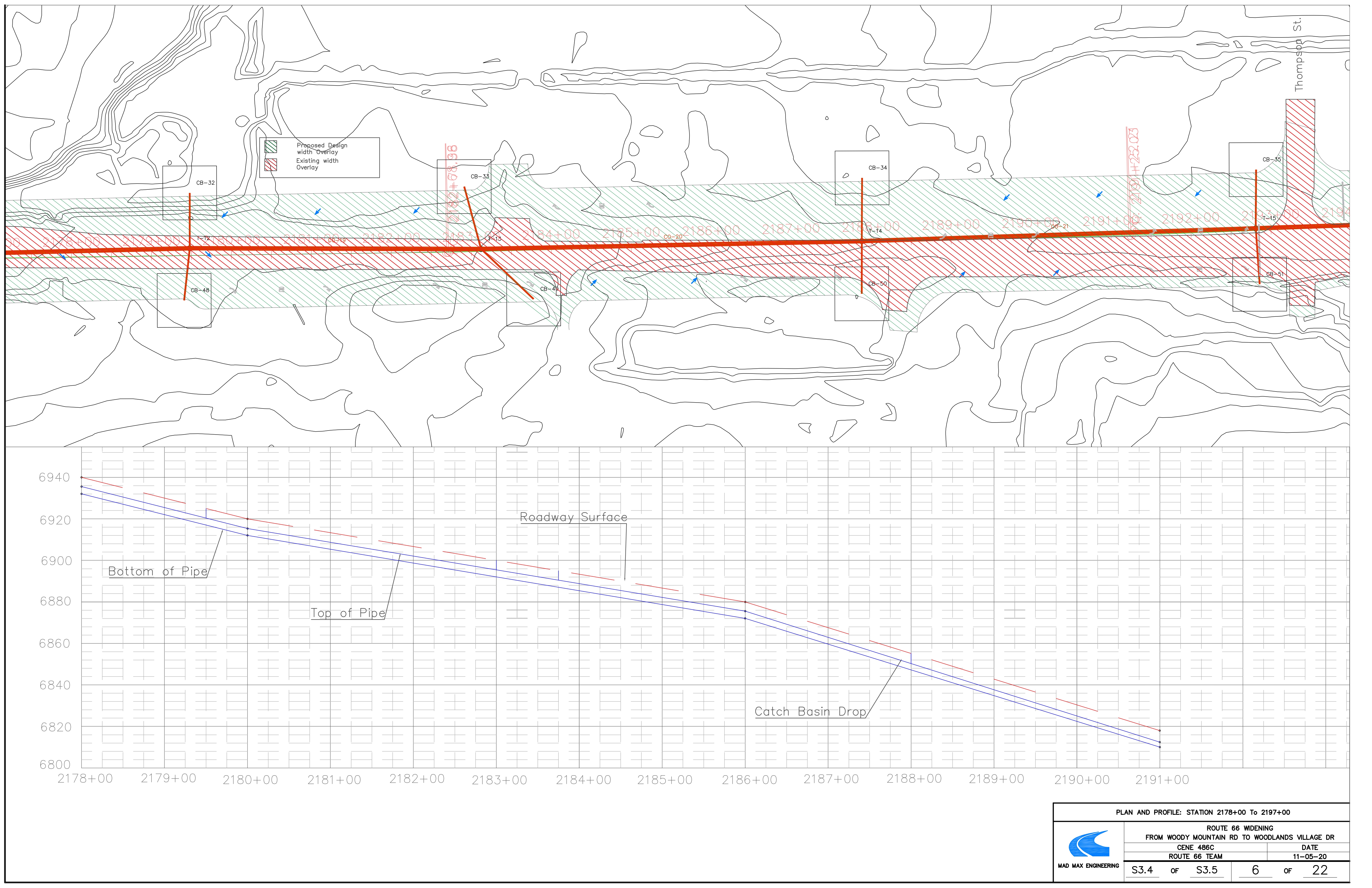
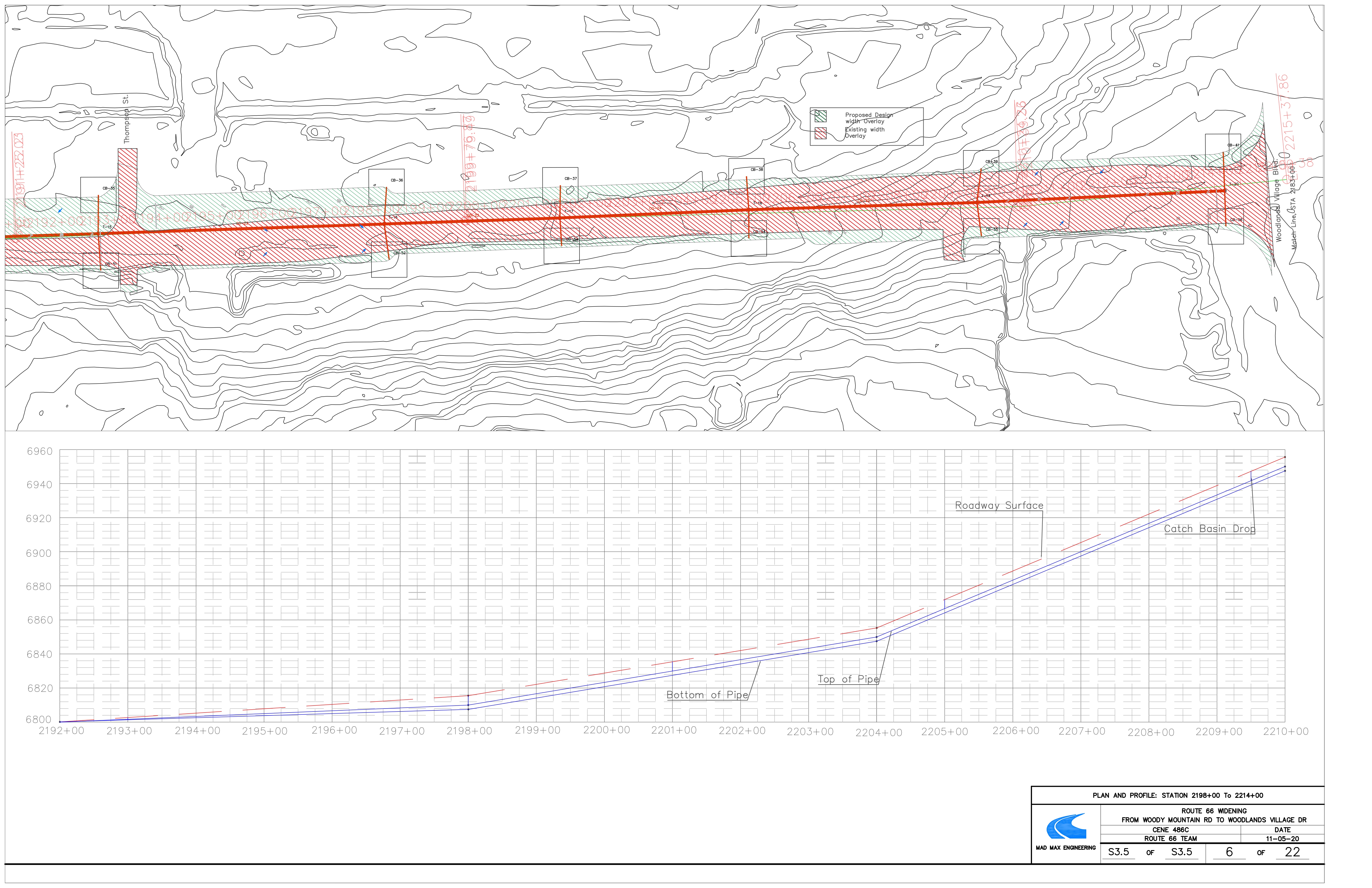
The following are sheets are a display the catch basin locations along Route 66 with the profile of the trunk line.
Catch Basin Details
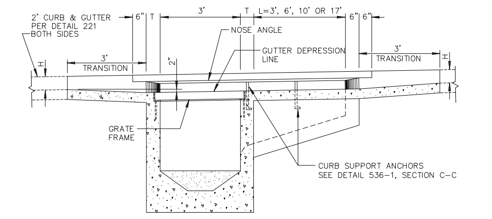
The following is the catch basin details that is in the the plan set. This detail is in reference with Maricopa Associations of Governments. This catch basin was selected and used for the analysis of storm water collection.

