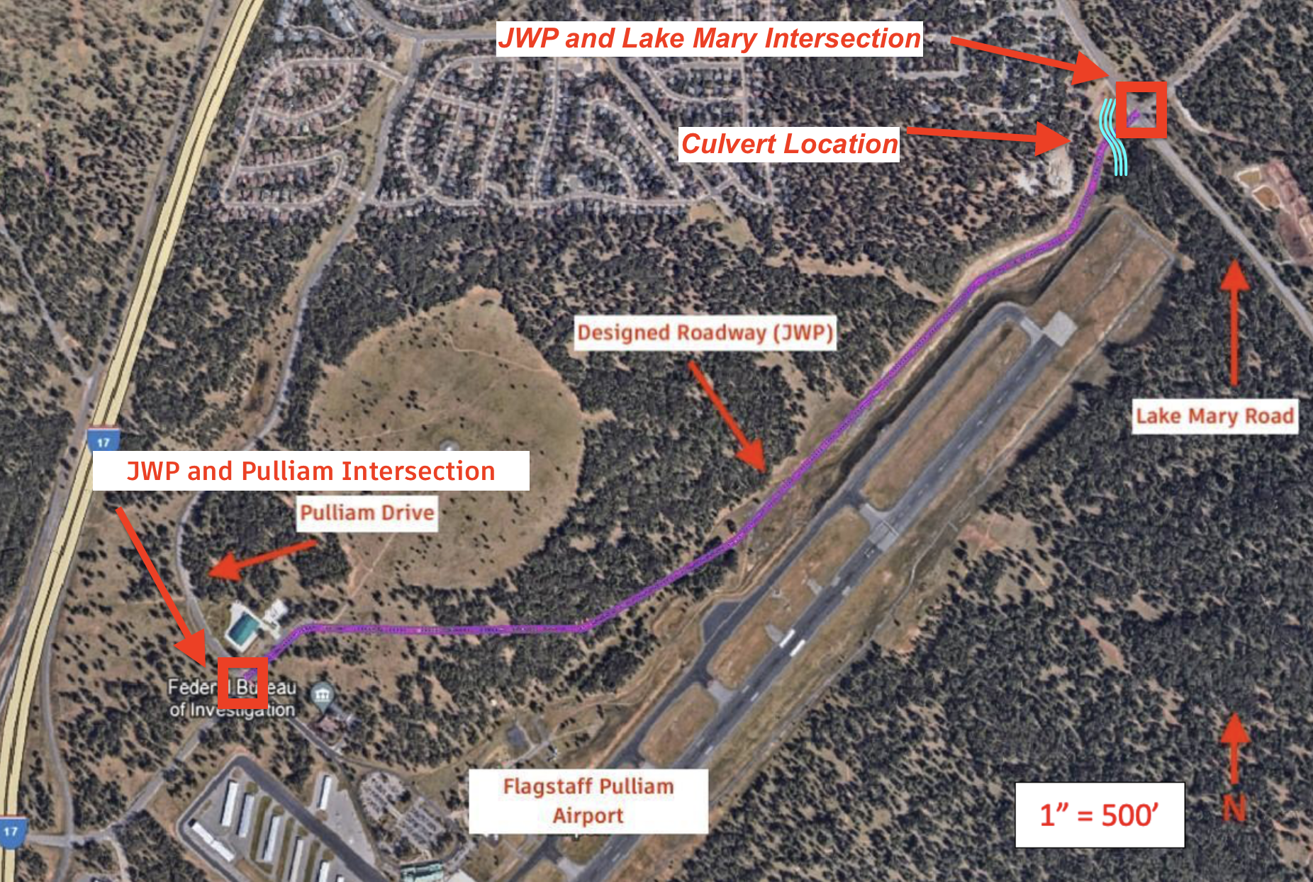
This page includes the key designs that contributed to the outcome of the project. This includes the culvert, roadway, pavement, and intersection designs.
Each design alternative was
analyzed against the established criteria to identify the most suitable option; each alternative was tested with 103-cfs from the 50-year storm event.
This analysis involved hydraulic modeling, cost estimation, constructability
assessment, and consideration of aesthetic preferences.
See below for the decision matrix
where each alternative was scored on a scale of 1-3; “1” is worst, “2” is neutral, and “3”
is good. As noted in yellow, the final design of the culvert was determined to be a double box culvert.

 Back to Top
The roadway was determined to be a 2 lane road with a shoulder/bike lane in each direction. A sidewalk was designed on the northern section of the road to serve pedestrians. The path of the roadway and its plan view can be seen below.

 Back to Top
The pavement design for this
project included the analysis of the structural and functional aspects
essential for constructing a durable, safe, and cost-effective road surface.
The final pavement design was analyzed based on durability, effectiveness, and
cost. The decision matrix below includes the design alternatives, criteria, and final decision denoted in yellow.

 Back to Top
Two intersections were designed for the designated
roadway, Lake Mary Rd. and John Wesley Powell Blvd. and S. Pulliam Dr. and John
Wesley Powell Blvd. Each intersection was designed using the projected 2045
traffic data and the teams traffic counts. Using the traffic counts, an engineer’s estimate was performed to project the turning and thru
volumes for each leg.
Lake Mary Road and JWP
The following figures show the decision matrix and final design for the Lake Mary Road and JWP intersection.


S. Pulliam Drive and JWP
The following figures show the decision matrix and final design for the S. Pulliam Drive and JWP intersection.

 Back to Top


 Back to Top

 Back to Top

 Back to Top


 Back to Top