Project Information
Location:
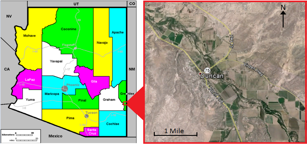
The project is located in Southeast Arizona in the Town of Duncan.The area of focus is along a 3.5 mile reach of the Gila River that is adjacent to the most developed areas in Duncan

Project Background:
Duncan, Arizona is an agricultural-based town of approximately 800 residents, most of whom live along the Gila River . The town is situated in southeast Arizona, near the New Mexico border, and is part of Greenlee County. The community erected in the 1870’s as a result of the mining industry in the nearby towns of Clifton and Morenci. Duncan became noticed by farmers and ranchers for its naturally irrigated lands along the Gila River . Early Duncan residents developed within the Gila River floodplain leading the town to experience significant flooding events throughout its history.
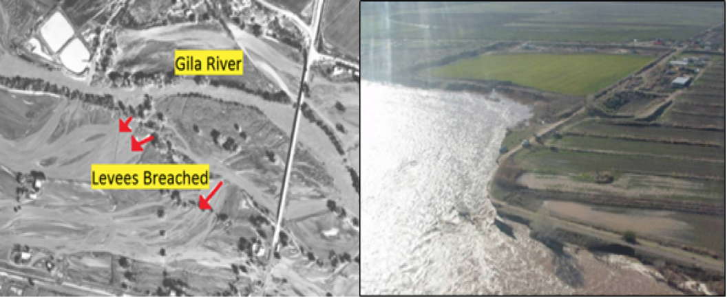
With the Gila River flowing on average of 200-400 cfs, the river is nearly always within the bounds of the main channel. For small-scale flooding events, less than 10 years, an agricultural dike serves to protect Duncan from flooding along the focused river reach. Under larger flood events, the dike lacks sufficient containment and has been breached multiple times. The largest flood on record occurred in December of 1978 when the Gila River reached a flow of nearly 60,000 cfs. The flood severely damaged local infrastructure and brought siltation and erosion damage to the agricultural properties. Damage was estimated at a total of $9 million (adjusted to the 2015 dollar) . Figure 1 and 2 Depict the conditions of Duncan during a flood.

Figure 1-Aeiral photo of the 1978 Figure 2–Duncan flood in 2005
To prevent flooding disasters, FEMA recommends levees be designed for at least 100 year flooding conditions. The 100 year flood for Duncan has recently been change from 28,500 cfs to 47,400 cfs based on a Letter of Map Revision for the upstream Town of Virden. This flood event poses a problem since Duncan’s agricultural dike is estimated to receive considerable damage beyond 7,000 cfs and potential failure at 20,000 cfs., according to the Flood Insurance Study performed in 2007. The study also declares, “the levees [dikes] have no effect on 100 and 500-year floods”. Since the levee is considered inadequate for large 100 year floods, FEMA does not recognize it when developing Flood Insurance Rate Maps (FIRM). As a result, much of the town is considered in high risk of flooding under base flood (100 year) conditions.
After modifying changes to topography and updating the 100 year flow conditions to 48,000 cfs, NAU Crown Engineering produced the corrected effective model, which is displayed in Figure 3. According to the models produced in HEC-RAS, the town may experience floodwaters of 3-7 feet in the defined floodplain. While floodplain remediation options may be explored to reduce the significance of flooding, the most effective solution is to implement a 1.9 mile long levee along the most developed areas of Duncan. The proposed levee can be seen in Figure 4 by the redline. This representation is the proposed conditions model, from which it can be seen how a levee would divert floodwaters from the town.

Figure 3-Corrected Effective Model Figure 4–Proposed Conditions Model
Categories :
Contact us: