Site Analysis
A preliminary site characterization consisting of a variety of different analyses was first conducted determine necessary site conditions. Site conditions including soil quality, vegetation and hydrology are summarized below.
Geotechnical Analysis
A geotechnical sieve analysis was conducted with soil grab samples collected from the SCRP site. Soil grain size and classification results produced from this analysis were important considerations when modeling channel roughness and bank stability. A total of six samples were collected from two separate cross sections along the channel. Figure 1 below displays the approximate location of soil sample cross-sections.
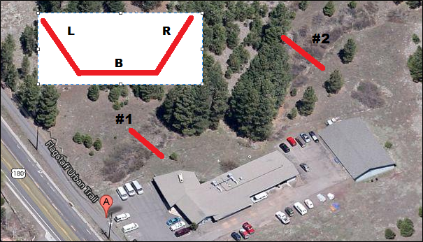
Figure 1: Soil Sample Collection
As shown above, soil sample cross-sections were located downstream (#1) near the culvert where channel entrenchment and erosion are putting the ACE parking lot in danger of failure and upstream (#2) where the channel is also highly entrenched and eroded. At each of the two cross-sections, grab samples were collected from river left (L), bottom (B) and right (R).
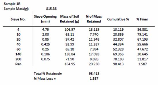
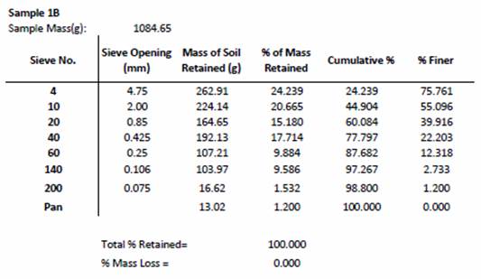
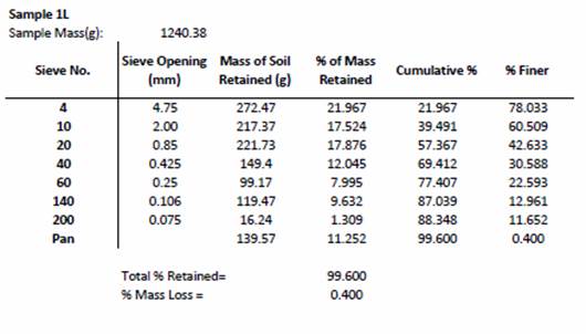
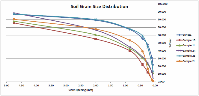
Each grab sample collected was analyzed for average soil particle diameter as per ASTM standard test methods for soil sieve analyses. Samples were dried, weighed and run through the sieve shaker. Soil remaining on each sieve screen was weighed and the grain size distribution curves were constructed for each sample. With the soil grain size distribution curves, average particle diameters were interpolated and an overall average soil diameter was found. Each soil sample was classified using the United Soil Classification System (USCS). All sieve analysis findings are displayed below.
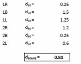
Average particle diameter and USCS soil classification results can be seen in the Soil Grain Size Distribution graph shown below. Based on each soil samples average particle size, an overall average grain size was found to be 0.84 mm, a characteristic of sand-sized particles. Similarly, USCS soil classification results all yielded soil types consisting primarily of sand.
Soil Sieve Analyses
Vegetation Analysis
Vegetation is an important component of all properly functioning riparian ecosystems. The use of vegetation along the banks adds support to bank stabilization. The plant community structure of the riparian environment of the SCRP site was measured using methods based on the Southern Colorado Plateau Network Riparian Monitoring Protocol (SCPN) of the National Park Service (NPS) Standard Operating Procedure (SOP) #6 and #8, Nested Plot Sampling Methods. The SOP method produces frequency and cover estimates of herbaceous, shrub, tree and grass species. A total of eight, 10m2 quadrant plots (SOP #8, 2007) were established along the channel from the culvert opening to the end of the reference reach, as seen in Figure 1 below.
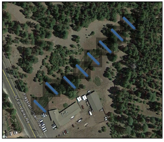
Figure 1: Vegetation Monitoring Site Locations
Vegetation was classified by species, plant type, and whether the species was native or invasive. A list of species identified is provided in the table below. A larger amount of vegetation was observed closer to the culvert. An indication of disturbance was observed in the increase of Artemisia dracunculus, Helianthus annuus, Verbascum, Marrubium vulgare, and Hordeum jubatum.
The vegetative analysis performed was based on specie abundance, or foliar coverage, in which the mean species cover was based on the cover class midpoints. The cover class midpoint ranges were provided from SOP #6 and determined to be 2.5%, 15.5%, 37.5%, 62.5%
The cover class midpoint range was determined and used in Equation 1, as seen below, to determine the total coverage of the species.
% = (1/n) S ci (Equation 1)
From Equation 1, the percent of coverage is determined by dividing the sum of the cover class midpoint range per quadrant (ci) by the number of quadrants on the plot (n). The number of quadrants on the plot was established to be 8. The specie abundance was calculated for each species, shown in Table 3.
Table 3: Species Abundance
Type of Vegetation |
Coverage Class Midpoint Range (%) |
Species Abundance (%) |
Sites with Significant variation |
Grass |
154 |
19.25 |
1, 2, 3, 5, 6 |
Herb |
81 |
10.125 |
1, 2, 3, 6 |
Shrub |
115 |
14.375 |
1, 2, 3, 6 |
Tree |
46 |
5.75 |
3, 4, 6, 7 |
Bareground |
141 |
17.625 |
1, 3, 5, 6, 8 |
As seen in Table 3, grass is shown to be the most abundant with 19.25% coverage, followed by bare ground with coverage of 17.63%. Trees had the least coverage with an abundance of 5.75%. From the observed data, the majority of the channel bed contains vegetation. By using the abundance of the species within the quadrants, excavation means can be determined based on the type of vegetation present. For areas with a higher coverage of trees, greater excavation efforts are required and use of larger equipment is needed. Also, due to the invasive species identified being herbs, a less costly excavation effort is required because the herbs have the second lowest coverage. . The presence of more native species allows the Riparian ecosystem to thrive. This data is assumed for seasonal periods with vegetation present.
Another aspect of the vegetative analysis was to determine the effectiveness of coyote willows for bank stabilization. In order to decrease the amount of erosion undercutting the parking lot, coyote willows will be planted on the bank sides to stabilize the soil with their roots. The tensile strength of the coyote willow root system was calculated to determine the strength of bonds between the soil and the roots. The tensile strength of a single root was determined using Equation 2 below.
![]() (Equation 2)
(Equation 2)
From Equation 2, D is the diameter of the root, a is the relationship constant and b is the scaling exponent. The diameter of the root was determined to be 5.7mm. The a was provided to be 34.5 and b was provided to be 1.02 (Encyclopedia of Agrophysics 635). After all variables were input, the tensile strength of a root was determined to be 5.84 kPa. Once one root’s tensile strength was determined, the tensile strength for the entire root system was calculated using Equation 3.
![]() (Equation 3)
(Equation 3)
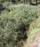
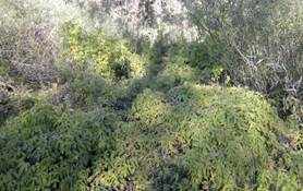
As seen in Equation 3, the sum of the tensile strengths of the roots determines the total tensile strength of the root structure. The area of the roots, Ari, was determined by multiplying the width (2m) by the depth (.92m) of the root system to get a total of 1.84m2. The cross sectional area of the soil, As, was determined to be 4m2. The total number of roots in the system was determined to be 6. The total tensile strength of the root system was determined to be 16.12kPa. The tensile strength of coyote willows is effective for the use of a bank stabilizer to prevent erosion because in order to prevent erosion, root systems must have a strength of 6.8-23.3 kPa (Dietrich 998). Coyote willows reproduce by sprouting shoots from the roots, so it is very easy for them to reproduce sporadically, as seen in Figure 2 below.
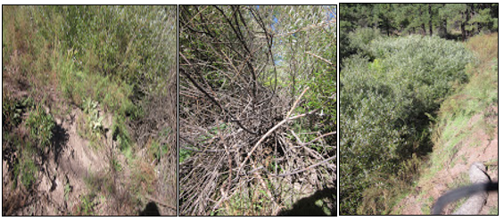
Figure 2: Coyote Willows (left to right) left bank, channel bed, and right bank
As seen in Figure 2, the coyote willows on the left bank are a great example of how they stabilize the bank. However, the coyote willows in the channel are a poor example of bank stabilization because they have shifted to the center of the channel from the bank. The area does not indicate new sprouts grew there because the willows are the same relative size as the willows on the bank. The coyote willows must be maintained to prevent sprouts from growing in the channel bed.
B.1.a: Plant Species On-Site
Item No. |
Plant Species |
Common Name |
Plant Type |
Native or Invasive |
1 |
Salix exigua |
Coyote Willow |
Shrub |
Native |
2 |
Pinus ponderosa |
Ponderosa Pine |
Tree |
Native |
3 |
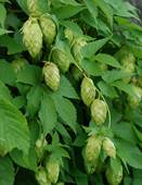
Humulus lupulus |
Hop |
Shrub |
Native |
4 |
Artemisia dracunculus |
Tarragon |
Herb |
Native |
5 |
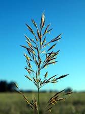
Bromus inermis |
Poaceae Grass |
Grass |
Native |
6 |
Erigeron divergens |
Spreading Fleabane |
Herb |
Native |
7 |
Verbena macdougalii |
MacDougal Verbena |
Herb |
Native |
8 |
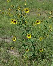
Helianthus annuus |
Sunflower |
Herb |
Native |
9 |
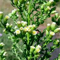
Conyza canadensis |
Horseweed |
Grass |
Native |
10 |
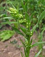
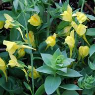
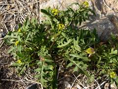
Linaria dalmatica |
Dalmatian Toadflax |
Herb |
Invasive |
11 |
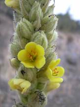
Verbascum |
Mullein |
Herb |
Native |
12 |
Bouteloua gracilis |
Blue Grama Grass |
Herb |
Native |
13 |
Bromus porteri |
Porter Brome |
Herb |
Native |
14 |
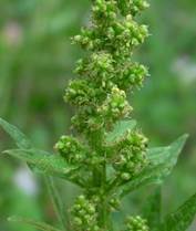
Chenopodium |
Goosefoot |
Herb |
Native |
15 |
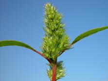
Amaranthus powellii |
Powell's Amaranth |
Herb |
Native |
16 |
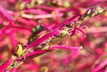
Kochia Scoparia |
Summer Cypress |
Herb |
Native |
17 |
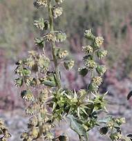
Ambrosia acanthicarpa |
Flatspine Burr Ragweed |
Herb |
Native |
18 |
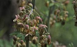
Thalictrum fendleri |
Fendler's Meadow-Rue |
Herb |
Native |
19 |
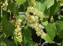
Vitis arizonica |
Canyon Grape |
Shrub |
Native |
20 |
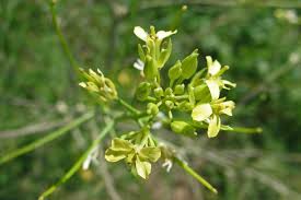
Sisymbrium altissimum |
Tumble Mustard |
Herb |
Invasive |
21 |
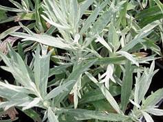
Artemisia Ludoviciana |
White Sagebrush |
Herb |
Native |
22 |
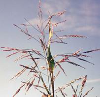
Panicum bulbosum |
Bulb Panic Grass |
Grass |
Native |
23 |
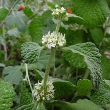
Marrubium vulgare |
White Horehound |
Herb |
Invasive |
24 |
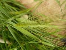
Hordeum jubatum |
Foxtail Barley |
Herb |
Invasive |
25 |
Muhlenbergia montana |
Mountain Muhly |
Herb |
Native |
26 |
Helenium hoopesii |
Sneezeweed |
Herb |
Native |
27 |
Juniperus osteosperma |
Utah Juniper |
Tree |
Native |
C.1.b: Visuals of Plant Species On-Site
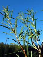
Figure 1: Coyote Willow (Salix exigua)
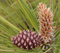
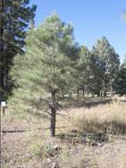
Figure 2: Ponderosa Pine (Pinus ponderosa)
Figure 3: Hop (Humulus lupulus)
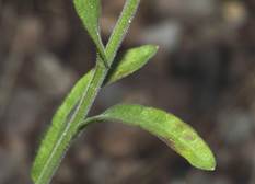
Figure 4: Tarragon (Artemisia dracunculus)
Figure 5: Poaceae Grass (Bromus inermis)
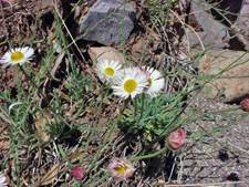
Figure 6: Spreading Fleabane (Erigeron divergens)
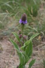
Figure 7: MacDougal Verbena (Verbena macdougalii)
Figure 8: Sunflower (Helianthus annuus)
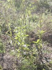
Figure 9: Horseweed (Conyza canadensis)
Figure 10: Dalmatian Toadflax (Linaria dalmatica)
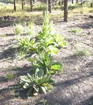
Figure 11: Mullein (Verbascum)
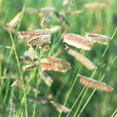
Figure 12: Blue Grama Grass (Bouteloua gracilis)
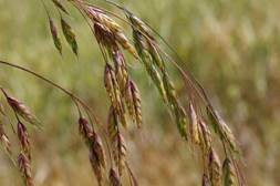
Figure 13: Porter Brome (Bromus porteri)
Figure 14: Goosefoot (Chenopodium)
Figure 15: Powell's Amaranth (Amaranthus powellii)
Figure 16: Summer Cypress (Kochia Scoparia)
Figure 17: Flatspine Burr Ragweed (Ambrosia acanthicarpa)
Figure 18: Fendler's Meadow-Rue (Thalictrum fendleri)
Figure 19: Canyon Grape (Vitis arizonica)
Figure 20: Tumble Mustard (Sisymbrium altissimum)
Figure 21: White Sagebrush (Artemisia Ludoviciana)
Figure 22: Bulb Panic Grass (Panicum bulbosum)
Figure 23: White Horehound (Marrubium vulgare)
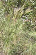
Figure 24: Foxtail Barley (Hordeum jubatum)
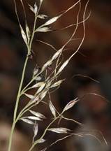
Figure 25: Mountain Muhly (Muhlenbergia montana)
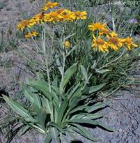
Figure 26: Sneezeweed (Helenium hoopesii)
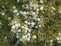
Figure 27: Utah Juniper (Juniperus osteosperma)

