Project Description:
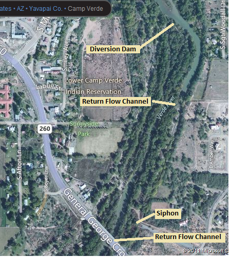
Approximately one half of a mile north of the Highway 260 Bridge crossing the Verde River in Camp Verde is a diversion structure for the Diamond-S Ditch. This structure completely diverts the flow in the Verde River channel to the Diamond-S ditch. The diverted flow varies throughout the year from 50 cubic feet per second [cfs] to 100 cfs. An electronically controlled sluice gate just north of the bridge is used to maintain a constant flow of approximately 30 cfs in the Diamond-S ditch while the remaining smaller portion of the flow is diverted back to the river channel. A gauge monitors the flow downstream of the sluice gate. If the flow varies from 30 cfs, the gauge signals the automatic sluice gate to increase or decrease the water being removed from the ditch.
The water diverted at the sluice gate makes a sudden elevation drop of six feet. The small orifice created by the sluice gate and the relatively high flow coming through create high velocities in the diversion flow. The combination of elevation change and high flow velocity create a barrier for even the strongest swimming fish in the river. This barrier prevents fish in the lower part of the Verde River from traveling back up the river when environment conditions in the lower part are less optimal. The goal of the project is to eliminate the barrier by providing a way for the fish to get back into the ditch from the Verde.
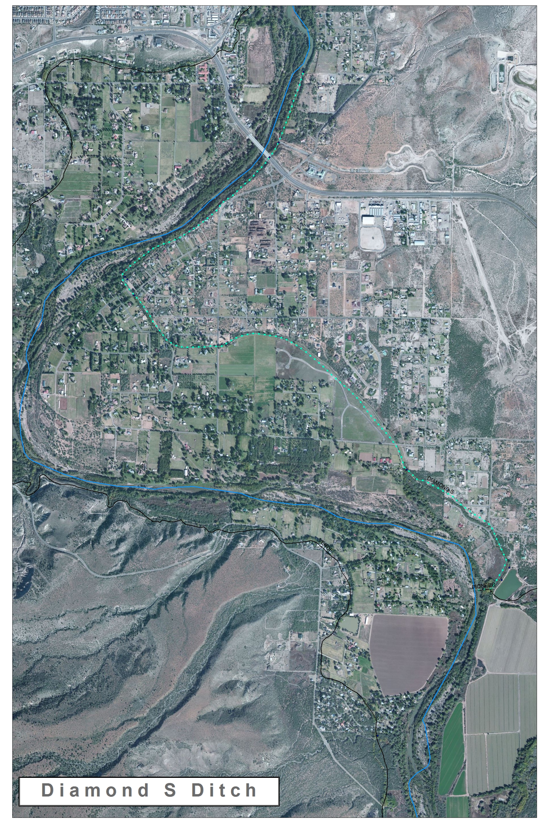
Diamond S Ditch is the green dotted line.

Project Site
Scope of Service
Several tasks are required to design a facility that allows upstream passage of fish and downstream passage of small recreational boats between the upper Diamond-S Ditch and the nearby Verde River. The tasks needed for this project can be divided up into eight categories, listed below.
1. Surveying
2. Geotechnical Analysis
3. Research
4. Hydraulic Analysis
5. Permitting
6. Final Design
Project Constraints
One potential challenge which could be encountered during this project is a conflict between constructing the new control device and continuing the flow at a high enough rate to meet the demand. The issue could be resolved by constructing the structure during a period when the fields would not require irrigation. A second potential challenge is construction costs. The possibility to include a canal large enough to accommodate canoes or kayaks would require earth removal and would increase the cost of the project. The control structure, which our group is designing, must be able to operate at low flow as well as high flow. The ability to operate at low flow will have important implications in the design of our structure and may eliminate the possibility to accommodate recreational river traffic. The environmentalist who is working on the ditch is attempting to convince the ditch managers to decrease the amount of water being drawn from the river; this could severely reduce the flow available for the fish ladder to work.
Final Design
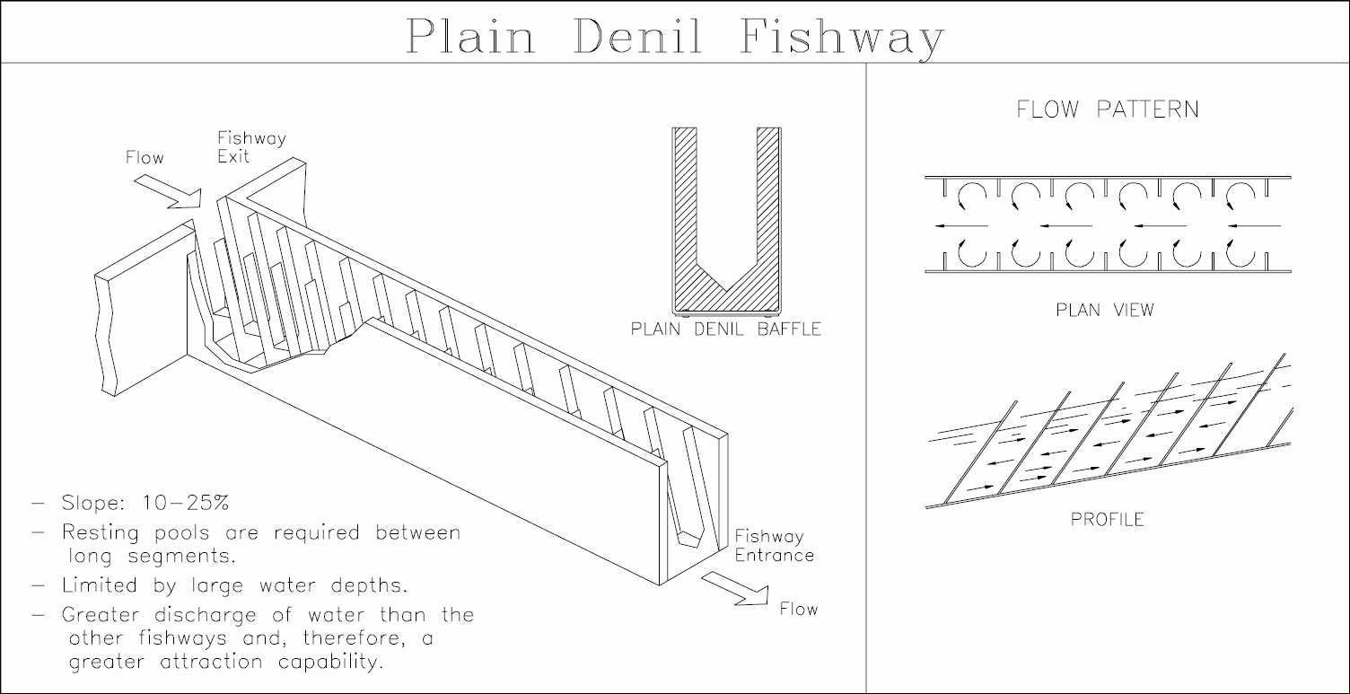
The final design was a Denil Fishway along with a overflow channel. The Denil Fishway was designed to have a capacity of 30cfs. The Denil Fishway was also the only design which could reduce the velocity to 2 ft/s which is the swimming velocity of the targeted fishes. The overflow channel was designed with a capacity of 70cfs. This was added to ensure the fishway does not flood as well as meet the criterion of the client of being able to divert the water during the offseason. These two design combine account for a total of 100cfs, which will easily handle the flows of the Diamond S Ditch. The figures below shows a Plain Denil Fishway and an AutoCAD drawing of the overflow channel.

